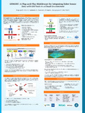
[en] The convergence of robotic technologies and sensor networks has generated vast amounts of data with potential applications in several domains like agriculture and urban planning. However, the lack of interoperability between this data and Geographic Information System (GIS) tools poses a challenge. The objective of GIS4IoRT (Geographic Information Systems for Internet of Robotic Things) project is the development of a “plug and play” and cloud-based middleware to bridge this gap, enabling seamless integration and visualization of multidimensional IoRT datasets within GIS environments.
Research Center/Unit :
GeoScITY
Disciplines :
Engineering, computing & technology: Multidisciplinary, general & others