
  | Kasprzyk, J.-P., Nys, G.-A., & Billen, R. (31 May 2024). Towards a multi-database CityGML environment adapted to big geodata issues of urban digital twins. International Archives of the Photogrammetry, Remote Sensing and Spatial Information Sciences, XLVIII-4/W10-2024, 101-106. doi:10.5194/isprs-archives-xlviii-4-w10-2024-101-2024  Peer Reviewed verified by ORBi Peer Reviewed verified by ORBi |
 | Ballouch, Z., Jeddoub, I., Hajji, R., Kasprzyk, J.-P., & Billen, R. (31 May 2024). Towards a Digital Twin of Liege: The Core 3D Model based on Semantic Segmentation and Automated Modeling of LiDAR Point Clouds. ISPRS Annals of the Photogrammetry, Remote Sensing and Spatial Information Sciences, X-4/W4-2024, 13-20. doi:10.5194/isprs-annals-x-4-w4-2024-13-2024 Peer Reviewed verified by ORBi |
 | Kharroubi, A., Ballouch, Z., Hajji, R., Yarroudh, A., & Billen, R. (09 April 2024). Multi-Context Point Cloud Dataset and Machine Learning for Railway Semantic Segmentation. Infrastructures, 9 (4), 71. doi:10.3390/infrastructures9040071 Peer Reviewed verified by ORBi |
 | Tamort, A., Kharroubi, A., Hajji, R., & Billen, R. (08 March 2024). 3D CHANGE DETECTION FOR SEMI-AUTOMATIC UPDATE OF BUILDINGS IN 3D CITY MODELS. International Archives of the Photogrammetry, Remote Sensing and Spatial Information Sciences, XLVIII-4/W9-2024, 349-355. doi:10.5194/isprs-archives-xlviii-4-w9-2024-349-2024 Peer Reviewed verified by ORBi |
 | Ballouch, Z., Hajji, R., Kharroubi, A., Poux, F., & Billen, R. (2024). Investigating Prior-Level Fusion Approaches for Enriched Semantic Segmentation of Urban LiDAR Point Clouds. Remote Sensing, 16 (2), 329. doi:10.3390/rs16020329 Peer Reviewed verified by ORBi |
  | Bachir, N., Harb, H., Zaki, C., Nabaa, M., Nys, G.-A., & Billen, R. (September 2023). PEMAP: An intelligence-based framework for post-event management of transportation systems. Computers and Electrical Engineering, 110, 108856. doi:10.1016/j.compeleceng.2023.108856 Peer Reviewed verified by ORBi |
 | El Yamani, S., Hajji Rafika, & Billen, R. (25 August 2023). IFC-CityGML Data Integration for 3D Property Valuation. ISPRS International Journal of Geo-Information, 12, 351. doi:10.3390/ijgi12090351 Peer Reviewed verified by ORBi |
 | Jeddoub, I., Nys, G.-A., Hajji, R., & Billen, R. (05 August 2023). Digital Twins for cities: Analyzing the gap between concepts and current implementations with a specific focus on data integration. International Journal of Applied Earth Observation and Geoinformation, 122, 103440. doi:10.1016/j.jag.2023.103440 Peer Reviewed verified by ORBi |
 | Nys, G.-A., & Billen, R. (2022). From consistency to flexibility: Handling spatial information schema thanks to a middleware in a 3D city modeling context. Transactions in GIS. doi:10.1111/tgis.13014 Peer Reviewed verified by ORBi |
 | Kharroubi, A., Poux, F., Ballouch, Z., Hajji, R., & Billen, R. (17 October 2022). Three Dimensional Change Detection Using Point Clouds: A Review. Geomatics, 2 (4), 457-486. doi:10.3390/geomatics2040025 Peer reviewed |
 | Ballouch, Z., Hajji, R., Poux, F., Kharroubi, A., & Billen, R. (16 July 2022). A Prior Level Fusion Approach for the Semantic Segmentation of 3D Point Clouds Using Deep Learning. Remote Sensing, 14 (14), 3415. doi:10.3390/rs14143415 Peer Reviewed verified by ORBi |
 | Donnay, J.-P., & Billen, R. (2022). Itinéraires de géographes : de la géomorphologie à la géomatique. Bulletin de la Société Géographique de Liège, 78 (1), 5-13. doi:10.25518/0770-7576.6708 Peer Reviewed verified by ORBi |
 | Nys, G.-A., Dubois, C., Goffin, C., Hallot, P., Kasprzyk, J.-P., Treffer, M., & Billen, R. (2022). ÉVALUATION DE LA QUALITÉ DES GÉODONNÉES ET OPERATIONALISATION DE LA DIRECTIVE INSPIRE : RETOUR D'EXPERIENCE. BSGLg, 78 (1), 179 - 188. doi:10.25518/0770-7576.6698 Peer Reviewed verified by ORBi |
 | Nys, G.-A., & Billen, R. (2021). From consistency to flexibility: A simplified database schema for the management of CityJSON 3D city models. Transactions in GIS. doi:10.1111/tgis.12807 Peer Reviewed verified by ORBi |
 | El Yamani, S., Hajji, R., Nys, G.-A., Ettarid, M., & Billen, R. (05 March 2021). 3D Variables Requirements for Property Valuation Modeling Based on the Integration of BIM and CIM. Sustainability, 13 (2814). doi:10.3390/su13052814 Peer reviewed |
 | Poux, F., Billen, R., Kasprzyk, J.-P., Lefebvre, P.-H., & Hallot, P. (07 October 2020). A Built Heritage Information System Based on Point Cloud Data: HIS-PC. ISPRS International Journal of Geo-Information, 9 (10), 588. doi:10.3390/ijgi9100588 Peer Reviewed verified by ORBi |
 | Nys, G.-A., Poux, F., & Billen, R. (31 August 2020). CityJSON Building Generation from Airborne LiDAR 3D Point Clouds. ISPRS International Journal of Geo-Information, 9 (521). doi:10.3390/ijgi9090521 Peer Reviewed verified by ORBi |
 | Poux, F., Valembois, Q., Mattes, C., Kobbelt, L., & Billen, R. (11 August 2020). Initial User-Centered Design of a Virtual Reality Heritage System: Applications for Digital Tourism. Remote Sensing, 12 (16), 2583. doi:10.3390/rs12162583 Peer Reviewed verified by ORBi |
 | Neuville, R., Pouliot, J., & Billen, R. (10 July 2019). Identification of the Best 3D Viewpoint within the BIM Model: Application to Visual Tasks Related to Facility Management. Buildings, 9 (7), 167. doi:10.3390/buildings9070167 Peer Reviewed verified by ORBi |
 | Poux, F., & Billen, R. (07 May 2019). Voxel-Based 3D Point Cloud Semantic Segmentation: Unsupervised Geometric and Relationship Featuring vs Deep Learning Methods. ISPRS International Journal of Geo-Information, 8 (5), 213. doi:10.3390/IJGI8050213 Peer Reviewed verified by ORBi |
 | Neuville, R., Pouliot, J., Poux, F., & Billen, R. (23 January 2019). 3D Viewpoint Management and Navigation in Urban Planning: Application to the Exploratory Phase. Remote Sensing, 11 (3), 236. doi:10.3390/rs11030236 Peer Reviewed verified by ORBi |
 | Billen, R., Binard, M., Cornet, Y., Hallot, P., Kasprzyk, J.-P., Warnant, R., & Sheeren, D. (2019). Un regard sur l’évolution de la géomatique : analyse de 4 décennies de recherche au sein du Département de Géographie de l’Université de Liège. Bulletin de la Société Géographique de Liège, (72), 11-32. Peer Reviewed verified by ORBi |
 | Deng, L., Jin, Y., Yan, L., Tesfamichael, S., Billen, R., Yao, Y., Yao, W., Chen, X., Fang, X., Wang, C., & Jing, X. (2019). Urban plant phenology monitoring: Expanding the functions of widespread surveillance cameras to nature rhythm understanding. Remote Sensing Applications: Society and Environment, 15. doi:10.1016/j.rsase.2019.05.001 Peer Reviewed verified by ORBi |
 | Poux, F., Neuville, R., Nys, G.-A., & Billen, R. (05 September 2018). 3D Point Cloud Semantic Modelling: Integrated Framework for Indoor Spaces and Furniture. Remote Sensing, 10 (9), 1412. doi:10.3390/rs10091412 Peer Reviewed verified by ORBi |
 | Van Ruymbeke, M., Hallot, P., Nys, G.-A., & Billen, R. (July 2018). Implementation of multiple interpretation data model concepts in CIDOC CRM and compatible models. Virtual Archaeology Review, 9 (19), 50-65. doi:10.4995/var.2018.8884 Peer Reviewed verified by ORBi |
 | Neuville, R., Pouliot, J., Poux, F., De Rudder, L., & Billen, R. (18 May 2018). A Formalized 3D Geovisualization Illustrated to Selectivity Purpose of Virtual 3D City Model. ISPRS International Journal of Geo-Information, 7 (5). doi:10.3390/ijgi7050194 Peer Reviewed verified by ORBi |
 | Agnello, A., Carré, C., Billen, R., Leyh, B., De Pauw, E., & Damblon, C. (2018). ULg Spectra: An Interactive Software Tool To Improve Undergraduate Students’ Structural Analysis Skills. Journal of Chemical Education, 95, 276-280. doi:10.1021/acs.jchemed.7b00712 Peer Reviewed verified by ORBi |
 | Poux, F., Neuville, R., Van Wersch, L., Nys, G.-A., & Billen, R. (30 September 2017). 3D Point Clouds in Archaeology: Advances in Acquisition, Processing and Knowledge Integration Applied to Quasi-Planar Objects. Geosciences, 7 (4), 96. doi:10.3390/geosciences7040096 Peer Reviewed verified by ORBi |
 | Hajji, R., & Billen, R. (September 2016). Collaborative 3D Modeling: Conceptual and Technical Issues. International Journal of 3-D Information Modeling, 5 (3), 47-67. doi:10.4018/IJ3DIM.2016070104 Peer Reviewed verified by ORBi |
 | Hallot, P., & Billen, R. (12 May 2016). Enhancing Spatio-Temporal Identity: States of Existence and Presence. ISPRS International Journal of Geo-Information, 5 (62). doi:10.3390/ijgi5050062 Peer Reviewed verified by ORBi |
 | Billen, R., Cutting-Decelle, A.-F., Métral, C., Falquet, G., Zlatanova, S., & Marina, O. (2016). Challenges of Semantic 3D City Models: A Contribution of the COST Research Action TU0801. International Journal of 3-D Information Modeling, 4 (2), 68-76. doi:10.4018/IJ3DIM.2015040106 Peer Reviewed verified by ORBi |
 | Campos, M., Tommaselli, A., Ivanova, I., & Billen, R. (12 October 2015). Data Product Specification Proposal for Architectural Heritage Documentation with Photogrammetric Techniques: A Case Study in Brazil. Remote Sensing, 7 (10), 13337-13363. doi:10.3390/rs71013337 Peer Reviewed verified by ORBi |
 | Hallot, P., Stewart, K., & Billen, R. (February 2015). Les états spatio-temporels d'existence et de présence. Revue Internationale de Géomatique, 25 (2), 173-196. Peer Reviewed verified by ORBi |
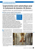 | Poux, F., Hallot, P., Jonlet, B., Carré, C., & Billen, R. (December 2014). Segmentation semi-automatique pour le traitement de données 3D denses : application au patrimoine architectural. XYZ: la Revue de l'Association Française de Topographie, 141 (36), 69-75. Peer reviewed |
 | Van Ruymbeke, M., Carré, C., & Billen, R. (2012). L'existant et l'ayant existé. Documenter le patrimoine dans la diachronie. Thema & Collecta, (2), 43 - 51. Peer reviewed |
 | Clementini, E., Billen, R., & Santic, M. (2011). Errata Corrige on “Modeling and Computing Ternary Projective Relations Between Regions”. IEEE Transactions on Knowledge and Data Engineering, 7-15. doi:10.1109/TKDE.2011.239 Peer Reviewed verified by ORBi |
 | Laube, P., Gottfried, B., Klippel, A., Billen, R., & Van de Weghe, N. (2011). Report on the first workshop on Movement Pattern Analysis (MPA10). Journal of Spatial Information Science, 2 (2011), 127-133. doi:10.5311/JOSIS.2011.2.8 Peer Reviewed verified by ORBi |
 | Clementini, E., Skiadopoulos, S., Billen, R., & Tarquini, F. (February 2010). A Reasoning System of Ternary Projective Relations. IEEE Transactions on Knowledge and Data Engineering, 22 (2), 161-178. doi:10.1109/TKDE.2009.79 Peer Reviewed verified by ORBi |
 | Teller, J., Billen, R., & Cutting-Decelle, A.-F. (February 2010). Bringing Urban Ontologies into Practice. Journal of Information Technology in Construction, 15. Peer Reviewed verified by ORBi |
 | Metral, C., Billen, R., Cutting-Decelle, A.-F., & Van Ruymbeke, M. (February 2010). Ontology-based approaches for improving the interoperability between 3D urban models. Journal of Information Technology in Construction, 15, 169-184. Peer Reviewed verified by ORBi |
 | Metral, C., Billen, R., Cutting-Decelle, A.-F., & Van Ruymbeke, M. (2010). Ontology-based approaches for improving the interoperability between 3D urban models. Formamente, 1-2 (V), 85-111. Peer Reviewed verified by ORBi |
 | Hallot, P., & Billen, R. (10 October 2008). Life and motion configuration: a basis for spatio-temporal generalised reasoning model. Lecture Notes in Computer Science, 5232/2008, 323-333. doi:10.1007/978-3-540-87991-6_39 Peer reviewed |
 | Laplanche, F., Teller, J., & Billen, R. (2008). Méthode de relevé rapide de scènes urbaines tridimensionnelles dans le cadre d’évaluations environnementales stratégiques. Revue Internationale de Géomatique, 18(2), 147-167. doi:10.3166/geo.18.147-167 Peer Reviewed verified by ORBi |
 | Billen, R., Laplanche, F., Zlatanova, S., & Emgard, L. (2008). Vers la création d’un méta-modèle générique de l’information spatiale 3D urbaine. XYZ: la Revue de l'Association Française de Topographie, 114 (1), 37-42. Peer reviewed |
 | Billen, R., & Kurata, Y. (2008). Refining Topological Relations between Regions Considering Their Shapes. Lecture Notes in Computer Science, 5266/2008, 20-37. doi:10.1007/978-3-540-87473-7_2 Peer reviewed |
 | Clementini, E., & Billen, R. (June 2006). Modeling and computing ternary projective relations between regions. IEEE Transactions on Knowledge and Data Engineering, 18 (6), 799-814. doi:10.1109/TKDE.2006.102 Peer Reviewed verified by ORBi |
 | Billen, R., & Clementini, E. (2006). Projective relations in a 3D environment. Lecture Notes in Computer Science, 4197, 18-32. doi:10.1007/11863939_2 Peer reviewed |
 | Billen, R., & Clementini, E. (2005). Semantics of Collinearity Among Regions. Lecture Notes in Computer Science, 1066-1076. doi:10.1007/11575863_129 Peer reviewed |
 | Billen, R., & Clementini, E. (2004). A model for ternary projective relations between regions. Lecture Notes in Computer Science, 310-328. doi:10.1007/978-3-540-24741-8_19 Peer reviewed |
 | Billen, R., & Clementini, E. (2004). Etude des caractéristiques projectives des objets spatiaux et de leurs relations. Revue Internationale de Géomatique, 14 (2), 145-165. Peer Reviewed verified by ORBi |
 | Billen, R., & Zlatanova, S. (2003). Conceptual issues in 3D Urban GIS. GIM International, 17 (1), 33-35. Peer reviewed |
 | Billen, R., & Zlatanova, S. (2003). 3D spatial relationships model: a useful concept for 3D cadastre? Computers, Environment and Urban Systems, 27 (4), 411-425. doi:10.1016/S0198-9715(02)00040-6 Peer Reviewed verified by ORBi |
 | Pantazis, D., Cornélis, B., Billen, R., & Sheeren, D. (January 2002). Establishment of a geographic data dictionnary : a case study of UrbIS 2 ©, the Brussels regional government GIS. Computers, Environment and Urban Systems, 26 (1), 3-17. doi:10.1016/S0198-9715(01)00012-6 Peer Reviewed verified by ORBi |
 | Billen, R., & Ballouch, Z. (14 May 2024). From semantic segmentation of LiDAR point clouds to 3D objects for digital twins [Paper presentation]. Beodays, Hasselt, Belgium. |
 | Nys, G.-A., & Billen, R. (22 September 2020). New 3D standards and perspectives [Paper presentation]. AM/FM Belux Webinars, Liège, Belgium. |
Billen, R., Dozo, B.-O., Etienne, A.-M., & Schyns, M. (19 December 2018). Développer des environnements virtuels pour l'enseignement. Teaching with VR [Paper presentation]. Séance de cours interdisciplinaire autour des usages de la réalité virtuelle dans l'enseignement, en présence du Ministre de l'Enseignement supérieur de la Fédération Wallonie-Bruxelles. |
 | Hallot, P., Poux, F., Neuville, R., & Billen, R. (18 October 2018). Utilisation des technologies d’acquisition 3D comme support à la compréhension matérielle de certains décors en partant du cas de l’oratoire de Germigny-des-Prés [Paper presentation]. Techniques, Décors et Patrimoine - Nécessités et limites d'intervention, Beez, Belgium. |
Billen, R., Poux, F., Hallot, P., Jonlet, B., & Luczfalvy Jancsó, A. (17 February 2016). Le patrimoine en 3D : de l’acquisition aux nuages de points intelligents [Paper presentation]. 19ème conférence Patrimoine du master complémentaire en conservation et restauration du patrimoine culturel immobilier, Centre des métiers du patrimoine « la Paix Dieu », Amay, Belgium. |
 | Billen, R. (27 November 2015). Le point sur les techniques de levé [Paper presentation]. "Des levés, pourquoi ?" Levés et représentations du patrimoine, le visible et l'invisible, Namur, Belgium. |
 | Billen, R., Van Ruymbeke, M., & Carré, C. (27 November 2015). Virtual Leodium: un exemple de gestion spatio-temporelle de données patrimoniales [Paper presentation]. "Des levés, pourquoi ?" Levés et représentations du patrimoine, le visible et l'invisible, Namur, Belgium. |
Billen, R. (17 September 2015). How education adapts to meet the requirements? [Paper presentation]. Final conference of the European Transfer of Innovation GeoSkills Plus project, Bruxelles, Belgium. |
 | Carré, C., Delfosse, V., Jeunejean, A., Vandervreken, A., Boulanger, C., Lefebvre, P.-H., Michel, B., Billen, R., & Leclercq, P. (24 May 2013). SpatioData: a platform for building information management [Paper presentation]. 5th Belgian Geographical Days, Louvain-la-Neuve, Belgium. |
Billen, R. (09 October 2012). Virtual Leodium : une tentative de modélisation spatio-temporelle 3D de l’information historique relative à l’urbanisme liégeois [Paper presentation]. Ecole thématique MoDyS 2012 [MOVE_REAL] du CNRS, Nice, France. |
Billen, R. (25 November 2011). 3D reference information needs and their impacts on data production [Paper presentation]. Conseil scientifique de l'IGN. |
Billen, R. (06 October 2009). 3D spatial models and analysis [Paper presentation]. PhD/young researcher Training School « 3D Geo-information for Disaster Management », TU Delft, Netherlands. |
 | Deliège, J.-F., Erpicum, M., Dassargues, A., Orban, P., Billen, R., Hallot, P., Petit, F., Van Campenhout, J., Levecq, Y., Pirotton, M., Archambeau, P., Everbecq, E., & Magermans, P. (September 2009). Etude et modélisation des impacts hydrologiques de pluies exceptionnelles dans un environnement valloné et boisé [Paper presentation]. Jeudi de l'Aquapôle, Sart Tilman, Belgium. |
Billen, R. (24 April 2008). Exploring needs and applicability of a 3D urban land register information system [Paper presentation]. Review of the Educational Trust of the Royal Institution of Chartered Surveyors (RICS), Londres, United Kingdom. |
Billen, R. (01 March 2005). 3D Urban GIS [Paper presentation]. Cours de 3eme cycle Spatial Query and Analysis using GIS, Glasgow, United Kingdom. |
Billen, R. (05 December 2003). Some aspects of Spatial Information Theory in Geographical Information Science [Paper presentation]. Department of Geography & Geomatics Research Seminar Series 2003-2004, Glasgow, United Kingdom. |
Billen, R. (15 November 2001). Présentation d’un nouveau modèle de relations spatiales et implémentation dans la structure 3D SSM [Paper presentation]. Forum contact et rencontre sur "Cartographie, SIGGIS et la troisième dimension", Bruxelles, Belgium. |
Billen, R. (25 June 1998). Conception d’un système de photogrammétrie digitale et développement de procédures de corrections et d’orientations [Paper presentation]. Meeting annuel de l’association AM/FM Belgium, Bruxelles, Belgium. |
Billen, R. (01 April 1998). Développement d’un système de photogrammétrie digitale [Paper presentation]. Conférences des jeunes licenciés 1997, Liège, Belgium. |
 | Jeddoub, I.* , Ballouch, Z.* , Hajji, R., & Billen, R. (2024). Enriched Semantic 3D Point Clouds: An Alternative to 3D City Models for Digital Twin for Cities? In T. H. Kolbe, A. Donaubauer, ... C. Beil (Eds.), Recent Advances in 3D Geoinformation Science - Proceedings of the 18th 3D GeoInfo Conference. Springer Science and Business Media Deutschland GmbH. doi:10.1007/978-3-031-43699-4_26 Peer reviewed* These authors have contributed equally to this work. |
 | Van Ruymbeke, M., Nofal, E., & Billen, R. (2022). 3D Digital Heritage and Historical Storytelling: Outcomes from the Interreg EMR Terra Mosana Project. In M. Rauterberg (Ed.), Culture and Computing - 10th International Conference, C and C 2022, Held as Part of the 24th HCI International Conference, HCII 2022, Proceedings (pp. 262-276). Springer Science and Business Media Deutschland GmbH. doi:10.1007/978-3-031-05434-1_17 Peer reviewed |
 | Nys, G.-A., Kharroubi, A., Poux, F., & Billen, R. (30 June 2021). An extension of CityJSON to support point clouds. International Archives of the Photogrammetry, Remote Sensing and Spatial Information Sciences, XLII-B4-2021, 301-306. doi:10.5194/isprs-archives-XLIII-B4-2021-301-2021 Peer Reviewed verified by ORBi |
 | Kharroubi, A., Van Wersch, L., Billen, R., & Poux, F. (17 June 2021). TESSERAE3D: A benchmark for tesserae semantic segmentation in 3D point clouds. ISPRS Annals of the Photogrammetry, Remote Sensing and Spatial Information Sciences, V-2-2021, 121–128. doi:10.5194/isprs-annals-V-2-2021-121-2021 |
 | Neuville, R., Jacynthe, P., & Billen, R. (03 September 2020). 3D Viewpoint Optimization of Topological Relationships: Application to 3D Cadastre for Visual Easement Validation. ISPRS Annals of the Photogrammetry, Remote Sensing and Spatial Information Sciences, VI-4/W1-2020, 135-142. doi:10.5194/isprs-annals-VI-4-W1-2020-135-2020 Peer Reviewed verified by ORBi |
 | Kharroubi, A., Billen, R., & Poux, F. (12 August 2020). MARKER-LESS MOBILE AUGMENTED REALITY APPLICATION FOR MASSIVE 3D POINT CLOUDS AND SEMANTICS. International Archives of the Photogrammetry, Remote Sensing and Spatial Information Sciences, XLIII (B2), 255–261. doi:10.5194/isprs-archives-XLIII-B2-2020-255-2020 Peer Reviewed verified by ORBi |
 | Nys, G.-A., Billen, R., & Poux, F. (2020). Automatic 3D Buildings Compact Reconstruction from LiDAR point clouds. International Archives of the Photogrammetry, Remote Sensing and Spatial Information Sciences, (XLIII-B2-2020), 473-478. doi:10.5194/isprs-archives-XLIII-B2-2020-473-2020 Peer Reviewed verified by ORBi |
 | Kharroubi, A., Hajji, R., Billen, R., & Poux, F. (29 November 2019). CLASSIFICATION AND INTEGRATION OF MASSIVE 3D POINTS CLOUDS IN A VIRTUAL REALITY (VR) ENVIRONMENT. International Archives of the Photogrammetry, Remote Sensing and Spatial Information Sciences, XLII-2 (W17), 165-171. doi:10.5194/isprs-archives-XLII-2-W17-165-2019 Peer Reviewed verified by ORBi |
 | Tabkha, A., Hajji, R., Billen, R., & Poux, F. (29 November 2019). Semantic enrichment of point cloud by automatic extraction and enhancement of 360° panoramas. International Archives of the Photogrammetry, Remote Sensing and Spatial Information Sciences, XLII-2 (W17), 355-362. doi:10.5194/isprs-archives-XLII-2-W17-355-2019 Peer Reviewed verified by ORBi |
 | Nys, G.-A., Kasprzyk, J.-P., Hallot, P., & Billen, R. (05 June 2019). A Semantic Retrieval System for Remote Sensing Web Platforms. International Archives of the Photogrammetry, Remote Sensing and Spatial Information Sciences, XLII-2 (W13), 1593-1599. doi:10.5194/isprs-archives-XLII-2-W13-1593-2019 Peer Reviewed verified by ORBi |
 | Nys, G.-A., Van Ruymbeke, M., & Billen, R. (13 October 2018). Spatio-temporal reasoning in CIDOC CRM: an hybrid ontology with GeoSPARQL and OWL-Time. CEUR Workshop Proceedings, 2230. Peer Reviewed verified by ORBi |
 | Nys, G.-A., Kasprzyk, J.-P., Hallot, P., & Billen, R. (19 September 2018). TOWARDS AN ONTOLOGY FOR THE STRUCTURING OF REMOTE SENSING OPERATIONS SHARED BY DIFFERENT PROCESSING CHAINS. International Archives of the Photogrammetry, Remote Sensing and Spatial Information Sciences, XLII (4), 483-490. doi:10.5194/isprs-archives-XLII-4-483-2018 Peer Reviewed verified by ORBi |
 | Hallot, P., & Billen, R. (2018). States of knowledge: a basis for spatio-temporal model of cultural heritage information. CEUR Workshop Proceedings. Peer Reviewed verified by ORBi |
 | Luczfalvy Jancsó, A., Jonlet, B., Delye, E., Hoffsummer, P., & Billen, R. (2018). An Analytical Framework for Classifying Software Tools and Systems Dealing with Cultural Heritage Spatio-Temporal Information. In P. Fogliaroni, A. Ballatore, ... E. Clementini (Eds.), Proceedings of Workshops and Posters at 13th International Conference on Spatial Information Theory (COSIT 2017) (pp. 325-337). Cham, Switzerland: Springer. doi:10.1007/978-3-319-63946-8_50 Peer reviewed |
 | Luczfalvy Jancsó, A., Hoffsummer, P., Billen, R., Jonlet, B., Hallot, P., & Poux, F. (2018). CASTLE4D : The Castle of Franchimont (Theux, Province of Liège, Belgium). In P. Ettel, A.-M. Flambard Héricher, ... K. O'Conor (Eds.), Château Gaillard 28 - L'environnement du château (pp. 191-195). Caen, France: Presses universitaires de Caen. |
 | Poux, F., Neuville, R., Hallot, P., & Billen, R. (26 October 2017). MODEL FOR REASONING FROM SEMANTICALLY RICH POINT CLOUD DATA. ISPRS Annals of the Photogrammetry, Remote Sensing and Spatial Information Sciences, IV-4/W5, 107-115. doi:10.5194/isprs-annals-IV-4-W5-107-2017 Peer Reviewed verified by ORBi |
 | Neuville, R., Pouliot, J., Poux, F., Hallot, P., De Rudder, L., & Billen, R. (26 October 2017). TOWARDS A DECISION SUPPORT TOOL FOR 3D VISUALISATION: APPLICATION TO SELECTIVITY PURPOSE OF SINGLE OBJECT IN A 3D CITY SCENE. ISPRS Annals of the Photogrammetry, Remote Sensing and Spatial Information Sciences, IV-4/W5, 91-97. doi:10.5194/isprs-annals-IV-4-W5-91-2017 Peer Reviewed verified by ORBi |
 | Van Ruymbeke, M., Hallot, P., & Billen, R. (17 August 2017). Enhancing CIDOC - CRM and compatible models with the concept of multiple interpretation. ISPRS Annals of the Photogrammetry, Remote Sensing and Spatial Information Sciences, Volume IV-2/W2, 287-294. doi:10.5194/isprs-annals-IV-2-W2-287-2017 Peer Reviewed verified by ORBi |
 | Poux, F., Neuville, R., Hallot, P., & Billen, R. (16 August 2017). POINT CLOUD CLASSIFICATION OF TESSERAE FROM TERRESTRIAL LASER DATA COMBINED WITH DENSE IMAGE MATCHING FOR ARCHAEOLOGICAL INFORMATION EXTRACTION. International Journal on Advances in Life Sciences, IV-2/W2, 203-211. doi:10.5194/isprs-annals-IV-2-W2-203-2017 Peer reviewed |
 | Poux, F., Neuville, R., Hallot, P., Van Wersch, L., Luczfalvy Jancsó, A., & Billen, R. (2017). DIGITAL INVESTIGATIONS OF AN ARCHAEOLOGICAL SMART POINT CLOUD: A REAL TIME WEB-BASED PLATFORM TO MANAGE THE VISUALISATION OF SEMANTICAL QUERIES. In Conservation of Cultural Heritage in the Digital Era (pp. 581-588). doi:10.5194/isprs-archives-XLII-5-W1-581-2017 Peer reviewed |
 | Luczfalvy Jancsó, A., Jonlet, B., Hallot, P., Hoffsummer, P., & Billen, R. (2017). Multiple Uses of a 3D Point Cloud: the Castle of Franchimont (Province of Liège, Belgium). In J. Hayes, C. Ouimet, M. Santana Quintero, S. Fai, ... L. Smith (Eds.), ISPRS - The International Archives of the Photogrammetry, Remote Sensing and Spatial Information Sciences. 26th International CIPA Symposium – Digital Workflows for Heritage Conservation (pp. 475-481). doi:10.5194/isprs-archives-XLII-2-W5-475-2017 Peer reviewed |
 | Poux, F., Neuville, R., Hallot, P., & Billen, R. (2016). Point Clouds as an Efficient Multiscale Layered Spatial Representation. In V. Tourre & F. Biljecki (Eds.), UDMV16: Eurographics Workshop on Urban Data Modelling and Visualisation. Geneve, Switzerland: The Eurographics Association. doi:10.2312/udmv.20161417 Peer reviewed |
 | Neuville, R., Poux, F., Hallot, P., & Billen, R. (05 October 2016). Towards a normalised 3D Geovisualisation : the viewpoint management. ISPRS Annals of the Photogrammetry, Remote Sensing and Spatial Information Sciences, IV-2 (W1), 179-186. doi:10.5194/isprs-annals-IV-2-W1-179-2016 Peer Reviewed verified by ORBi |
 | Poux, F., Neuville, R., Hallot, P., & Billen, R. (05 October 2016). SMART POINT CLOUD: DEFINITION AND REMAINING CHALLENGES. ISPRS Annals of the Photogrammetry, Remote Sensing and Spatial Information Sciences, IV-2 (W1), 119-127. doi:10.5194/isprs-annals-IV-2-W1-1-2016 Peer Reviewed verified by ORBi |
 | Luczfalvy Jancsó, A., Billen, R., Hoffsummer, P., Jonlet, B., Hallot, P., & Poux, F. (2016). CASTLE4D: An Archaeological Information System Based on 3D Point Clouds. In J. L. Lerma & M. Cabrelles (Eds.), Proceedings of the Arqueológica 2.0 - 8th International Congress on Archaeology, Computer Graphics, Cultural Heritage and Innovation : Universitat Politècnica de València, Valence 5-7 septembre 2016 (pp. 247-252). València, Spain: Editorial Universitat Politècnica de València. doi:10.4995/arqueologica8.2016.4210 Peer reviewed |
 | Hallot, P., Stewart, K., & Billen, R. (2015). Who are my Visitors and Where do They Come From? An Analysis Based on Foursquare Check-ins and Place-based Semantics. Eurographics Workshop on Urban Data Modelling and Visualisation 2015, 55-58. doi:10.2312/udmv.20151350 Peer reviewed |
 | Van Ruymbeke, M., Carré, C., Delfosse, V., Pfeiffer, M., & Billen, R. (2015). Towards an Archaeological Information System: Improving the Core Data Model. In F. Giligny, F. Djindjian, L. Costa, P. Moscati, ... S. Robert (Eds.), CAA 2014 21st century Archaeology : Concepts methods and tools : Proceedings of the 42nd Annual Conference on Computer Applications and Quantitative Methods in Archaeology (pp. 245-253). Oxford, United Kingdom: Archaeopress. Peer reviewed |
 | Campos, M. B., De Moraes, M. A., Tommaselli, A. M. G., Ivánová, I., & Billen, R. (2014). ANÁLISE DE REQUISITOS PARA AVALIAÇÃO DE QUALIDADE GEOMÉTRICA NO REGISTRO DO PATRIMÔNIO ARQUITETÔNICO COM TÉCNICAS FOTOGRAMÉTRICAS. In C. A. Nome, A. L. de Magalhães Cordeiro, ... G. C. Rocha (Eds.), Anais ARQDOC 2014 INFORMAÇÃO E CONHECIMENTO PARA PRESERVAÇÃO (pp. 34-43). João Pessoa, Brazil: EDITORA DA UFPB. Peer reviewed |
 | Delfosse, V., Boulanger, C., Jeunejean, A., Carré, C., Billen, R., & Leclercq, P. (2014). SPATIODATA, un modèle de bâtiment non-constructif, collaboratif et multi-usage. In Actes du 6ème Séminaire de Conception Architecturale Numérique. Peer reviewed |
 | Ben Rajeb, S., Delfosse, V., Boulanger, C., Jeunejean, A., Carré, C., Billen, R., & Leclercq, P. (2014). Projet de recherche appliquée SpatioData : Spécification d’un système participatif pour la réutilisation de données sporadiques sur le bâtiment. In Proceedings du colloque 01'Design 9. Peer reviewed |
 | Carré, C., Delfosse, V., Billen, R., Jeunejean, A., Boulanger, C., Vandervreken, A., Lefèbvre, P.-H., Michel, B., & Leclercq, P. (2013). SPATIODATA, une approche alternative pour la gestion des données spatialisées relatives aux bâtiments. In Thibaud (Ed.), Gourmelon (Ed.), J. Gensel (Ed.), T. Joliveau (Ed.), C. Claramunt (Ed.), ... A. Ruas (Other coll.), SAGEO 2013 - Conférence internationale de Géomatique et d'analyse spatiale - ACTES de la Conférence. Peer reviewed |
 | Pfeiffer, M., Carré, C., Delfosse, V., Hallot, P., & Billen, R. (2013). Virtual Leodium: From an historical 3D city scale model to an archaeological information system. In Grussenmeyer (Ed.), ISPRS Annals – Volume II-5/W1, 2013. Strasbourg, France: Copernicus Publications. Peer reviewed |
 | Delfosse, V., Billen, R., & Leclercq, P. (2012). UML as a schema candidate for Graph databases. In NoSql Matters 2012. |
 | Billen, R., Blain, P., Donneau, O., Habraken, S., Renotte, Y., & Van Ruymbeke, M. (2009). Virtual model of the city of Liège in the eighteen century - "Virtual Leodium". In J. Verly (Ed.), Proceedings of 3D Stereo MEDIA 2009, International 3D Stereo Film and Technology Festival (3D Stereo MEDIA), Liège, Belgium, 1-3 Dec. 2009. Peer reviewed |
 | Hallot, P., & Billen, R. (2009). A pyramidal classification of ST relationship models. In N. Van de Weghe, B. Gottfried, P. De Maeyer, ... R. Billen (Eds.), Proceedings of the 3th Workshop on Behaviour Monitoring and Interpretation. Peer reviewed |
 | Kasprzyk, J.-P., & Billen, R. (2009). A Geocodification for 3D objects terrestrial surveys. In T. Neutens, M. De Ryck, ... P. De Maeyer (Eds.), Proceedings of the 4th International Workshop on 3D Geo-information (pp. 129-142). Peer reviewed |
 | Sainovic, I., & Billen, R. (2009). A way to improve management of underground utilities. In P. De Mayer, T. Neutens, ... M. De Ryck (Eds.), Proceedings of the 4th International Workshop on 3D Geo-Information (pp. 197-209). Peer reviewed |
 | Hallot, P., & Billen, R. (2008). Life and Motion Configuration [Paper presentation]. 5th International Conference on Geographic Information Science (GIScience 08), Park City, Utah, United States. Peer reviewed |
 | Van Ruymbeke, M., Tigny, V., De Bats, E., Garcia Moreno, R., & Billen, R. (2008). Development and use of a 4D GIS to support the conservation of the Calakmul site (Mexico, World Heritage Programme). In M. Ioannides (Ed.), VSMM 2008. Digital Heritage. Proceedings of the 14th International Conference on Virtual Systems and Multimedia (pp. 117 - 121). Budapest, Hungary: Archaeolingua. Peer reviewed |
 | Van Ruymbeke, M., Tigny, V., De Bats, E., Garcia Moreno, R., & Billen, R. (2008). Development and use of a 4D GIS to support the conservation of the Calakmul site (Mexico, World Heritage Programme) [Paper presentation]. Advances on Remote Sensing for Archaeology and Cultural Heritage Management, proceedings of the 1st International EARSeL Workshop CNR, Rome, September 30 - October 4, 2008, Rome, Italy. Peer reviewed |
 | Hallot, P., & Billen, R. (2007). Spatio-temporal configurations of dynamics points in a 1D space. In B. Gottfired (Ed.), Workshop on Behaviour Monitoring and Interpretation BMI'07 (pp. 77-90). Germany: University of Bremen. Peer reviewed |
Chaidron, C., Teller, J., & Billen, R. (2006). Investigating a bottom-up approach for extracting domain ontologies from urban databases. In Proceedings of the 1st Workshop of COST Action C21 Towntology. Peer reviewed |
Pantazis, D., Donnay, J.-P., & Billen, R. (2006). GIS Design and Implementation Methods: The MECOSIG Improvement and Updating Project. In Proceedings of the 25th UDMS Symposium. Peer reviewed |
 | Billen, R. (2004). A projective approach to handle 3D spatial data. In Proceedings of GIS Research UK 2004 (pp. 237-240). Peer reviewed |
 | Billen, R., & Clementini, E. (2002). Projective and Affine Spatial Operators for Regions. In M. Joo Er, C. D'Attelis, ... M. Mastorakis (Eds.), Proceedings of WSEAS International Conferences MCBC, MCBE, ICAMSL, ICAI. Peer reviewed |
 | Laboury, D., Renotte, Y., Tilkens, B., Dominique, M., Da Col, A., Schumacker, B., Billen, R., Cornet, Y., & Cornélis, B. (2002). The OSIRIS Project (Optical Systems for Interferometric-Photogrammetric Relief Investigation and Scanning). Development of a device for 3D numerical recording of archaeological and epigraphic documents by optoelectronic processes. In W. Boehler (Ed.), PROCEEDINGS OF THE CIPA WG 6 INTERNATIONAL WORKSHOP ON SCANNING FOR CULTURAL HERITAGE RECORDING. Peer reviewed |
Da Col, A., Billen, R., Schumacker, B., Ewiak, I., & Kaczynski, R. (2002). Educational Software for Digital Photogrammetry. In Arch. of Photogrammetry, Cartography and Remote Sensing (pp. 79 - 84). Peer reviewed |
 | Laboury, D., Renotte, Y., Tilkens, B., Dominique, M., Billen, R., & Cornet, Y. (2002). The OSIRIS Project (Optical Systems for Interferometric-Photogrammetric Relief Investigation and scanning), Development of a device for 3D numerical recording of archaeological and epigraphic documents by optoelectronic processes. In Proceedings of the CIPA WG6 international workshop on Scanning for Cultural Heritage Recording (pp. 139-142). Peer reviewed |
Billen, R., & Zlatanova, S. (2001). 3D spatial relationships model: a useful concept for 3D cadastre? In P. Van Oosterom, J. Stoter, ... E. Fendel (Eds.), Registration of properties in strata - International workshop on « 3D cadastre » (pp. 223-241). Peer reviewed |
 | Ewiak, I., Billen, R., Cornélis, B., Kaczynski, R., Donnay, J.-P., & Schumacker, B. (2000). Polish – Belgian co-operation. Development of an educational photogrammetric software. In Proceedings of the ISPRS 2000 (pp. 96-101). Peer reviewed |
 | Billen, R. (2000). Integration of 3D information in Urban GIS :a conceptual view. In Proceedings of the ISPRS 2000 (pp. 79-84). Peer reviewed |
Pantazis, D., Cornélis, B., Sheeren, D., & Billen, R. (2000). Establishment of a geographic data dictionnary : case study on the Brussels regional government GIS. In Proceedings of the 22nd Urban and Data Management Symposium (pp. 11-26). Peer reviewed |
Cornélis, B., Billen, R., & Pantazis, D. (1999). Localisation géographique, référence spatiale et SIG pour l’étude des transports. In Actes des « Journée GPS, GIS et Cartographie électronique » (1999/12/06). Peer reviewed |
Billen, R., Cornélis, B., Sheeren, D., Donnay, J.-P., & Pantazis, D. (1999). Influence de la précision absolue des points d'amer sur la qualité de la géoréférenciation des images à très haute résolution. In La télédétection en francophonie : analyse critique et perspective, Huitième journées scientifiques du "Réseau Télédétection" de l'Aupelf-Uref (pp. 15-22). Peer reviewed |
 | Billen, R. (19 April 2024). Transforming Semantic Point Clouds into Functional 3D Objects: Exploring City Digital Twin Technology [Paper presentation]. African SmartCity Forum, Benguerir, Morocco. |
Billen, R., Jeddoub, I., & Macq, H. (13 June 2023). Digital Twin Hype: Threat or Opportunity for PMAs? [Paper presentation]. EuroSDR/AGILE 2023 Workshop - How can GI science advance the value of city-level and nationwide Digital Twins?, Delft, Netherlands. |
 | El Yamani, S., Billen, R., & Hajji, R. (02 July 2020). Towards a CityGML 3D Property Valuation Model based on BIM [Paper presentation]. Gist seminar, online, Netherlands. |
Billen, R. (18 June 2020). The Coudenberg Heritage Building Information System [Paper presentation]. FAIR Heritage: Digital Methods, Scholarly Editing and Tools for Cultural and Natural Heritage, Tours, France. |
Orban, A., Barbier, C., Billen, R., Nys, G.-A., Kasprzyk, J.-P., Neyt, X., Stasolla, M., Beaumont, B., Tychon, B., & Wellens, J. (28 November 2019). EO_Regions_Science: Basic Research in support of EO_Regions! [Paper presentation]. Belgian Earth Observation Day (BEODay). |
 | Kasprzyk, J.-P., Nys, G.-A., & Billen, R. (18 October 2019). Integration of multiple sensor data into a 3D GIS for cities monitoring [Paper presentation]. Belgium Geographers Days, Ghent, Belgium. |
 | Nys, G.-A., Kasprzyk, J.-P., Hallot, P., & Billen, R. (13 June 2019). A Semantic Retrieval System for Remote Sensing Web Platforms [Paper presentation]. ISPRS GeoSpatial Week 2019, Enschede, Netherlands. |
 | Hallot, P., Van Ruymbeke, M., & Billen, R. (23 April 2019). TerraMosana, l’évolution de notre territoire racontée en 3D [Paper presentation]. Museohub 7ème édition - 3D & Patrimoine - Quels impacts sur la recherche ? Quelles modalités pour la médiation ?, St Omer, France. |
Nys, G.-A., Van Ruymbeke, M., & Billen, R. (28 August 2018). Spatio-temporal reasoning in CIDOC CRM: an hybrid ontology with GeoSPARQL and OWL-Time [Paper presentation]. 2nd Workshop On Computing Techniques For Spatio-Temporal Data in Archaeology And Cultural Heritage, Melbourne, Australia. |
 | Poux, F., Billen, R. (Other coll.), Hallot, P. (Other coll.), Luczfalvy Jancsó, A. (Other coll.), Neuville, R. (Other coll.), Nys, G.-A. (Other coll.), & Van Wersch, L. (Other coll.). (08 March 2018). Fusion de données lasergrammétriques/photogrammétriques et techniques d'extraction d'information archéologique sur base de nuage de points 3D [Paper presentation]. Patrimoine, modélisation numérique et systèmes d’acquisition d’informations : les enjeux actuels de la recherche, Lille, France. |
 | Poux, F., Luczfalvy Jancsó, A. (Other coll.), Jonlet, B. (Other coll.), & Billen, R. (Other coll.). (08 March 2018). Numérisation 3D par lasergrammétrie et photogrammétrie: applications à la Réalité Virtuelle [Paper presentation]. Patrimoine, modélisation numérique et systèmes d’acquisition d’informations : les enjeux actuels de la recherche, Lille, France. |
Van Wersch, L., Hocquet, F.-P., Strivay, D., Poux, F., Billen, R., Kronz, A., Simon, K., Camerlynck, C., & Sapin, C. (2018). Recherches récentes sur le site de Germigny-des-Prés (Loiret, France) [Paper presentation]. Journées archéologiques de la Région Centre Val-de-Loire, Tours, France. |
Orban, A., Barbier, C., Billen, R., Nys, G.-A., Kasprzyk, J.-P., Neyt, X., Stasolla, M., Tychon, B., & Wellens, J. (January 2018). EO_Regions_Science: Basic Research in support of EO_Regions! [Paper presentation]. Belgian Earth Observation Day (BEODay), Beersel, Belgium. |
Van Wersch, L., Hocquet, F.-P., Strivay, D., Poux, F., Billen, R., Kronz, A., Simon, K., Camerlynck, C., & Sapin, C. (2018). The carolingian site of Germigny-des-Prés (Loiret, France), micro and macro-scales methods for the identification of a mosaic production [Poster presentation]. 42d Syposium of archaeometry, ISA 2018, Merida, Mexico. Peer reviewed |
Billen, R., Dozo, B.-O., Etienne, A.-M., Schyns, M., & Haubruge, E. (23 November 2017). Teaching with VR. Développer des environnements virtuels pour l'enseignement en sciences humaines [Paper presentation]. Semaine de l'enseignement. Atelier 2 - Les outils numériques « made in ULiège », Liège, Belgium. |
Billen, R., Poux, F., & Van Ruymbeke, M. (02 November 2017). Smart Point Clouds for information modelling: application in Cultural Heritage [Paper presentation]. Annual Netherlands Centre for Geodesy and Geo-Informatics (NCG) Symposium, Delft, Netherlands. |
Poux, F., Neuville, R., Kasprzyk, J.-P., Nys, G.-A., Hallot, P., Luczfalvy Jancsó, A., Jonlet, B., & Billen, R. (12 September 2017). LiDAR aérien et autres nuages de points pour la cartographie multi-échelles [Paper presentation]. Workshop LiDAR, Namur, Belgium. |
Luczfalvy Jancsó, A., Jonlet, B., Hallot, P., Hoffsummer, P., & Billen, R. (29 August 2017). Multiple Uses of a 3D Point Cloud: the Castle of Franchimont (Province of Liège, Belgium) [Poster presentation]. Digital Workflows for Heritage Conservation. CIPA 2017 - 26th International Symposium, Ottawa, Canada. |
Billen, R. (14 October 2016). The Terra Mosana Project [Paper presentation]. 7ème rencontre rhéno-mosane d'archéologues / Siebtes rhein-maasländisches archäologen-treffen / Zevende Rijn- en Maaslandes bijeenkomst van archeologen, Tongeren, Belgium. |
 | Hallot, P., Billen, R., Poux, F., Van Ruymbeke, M., Neuville, R., & Luczfalvy Jancsó, A. (23 September 2016). Applications des relevés 3D au patrimoine, de l'acquisition au système d'information 3D [Paper presentation]. 13ème Journées de la Topographie - Données topographiques du futur : du numérique au virtuel. |
Luczfalvy Jancsó, A., Hoffsummer, P., Billen, R., Jonlet, B., Hallot, P., & Poux, F. (16 August 2016). CASTLE4D : The castle of Franchimont [Poster presentation]. Château Gaillard XXVIII - Castles and Landscapes, Roscommon, Ireland. |
 | Billen, R., Van Ruymbeke, M., Pfeiffer, M., Carré, C., Jonlet, B., Poux, F., Luczfalvy Jancsó, A., Neuville, R., & Hallot, P. (20 April 2016). Vers des systèmes d’information archéologique : maquette virtuelle et nuages de points intelligents [Paper presentation]. Maquettes et restitutions, Lille, France. |
 | Poux, F., & Billen, R. (17 December 2015). Smart point cloud: Toward an intelligent documentation of our world [Paper presentation]. The Professionnal Conference (PCON) 2015, Liège, Belgium. |
 | Van Ruymbeke, M., Carré, C., Delfosse, V., Hallot, P., Pfeiffer, M., & Billen, R. (25 April 2014). Towards an Archaeological Information System: improving the core data model [Paper presentation]. Computer Applications and Quantitative Methods in Archaeology. CAA 2014, Paris, France. |
 | Poux, F., & Billen, R. (06 September 2013). Semi-automatic and versatile point-cloud segmentation by region growing based on normal estimation [Poster presentation]. 14ème CIPA International Symposium, Strasbourg, France. |
 | Poux, F., & Billen, R. (02 September 2013). Recording, Documentation and Cooperation for Cultural Heritage [Poster presentation]. CIPA13, Strasbourg, France. |
 | Pfeiffer, M., Carré, C., Delfosse, V., & Billen, R. (14 May 2013). Virtual Leodium: Development of an archaeological information system, a case study on an historical 3D city scale model [Paper presentation]. AGILE 2013 - Workshop on INTEGRATING 4D, GIS AND CULTURAL HERITAGE, Leuven, Belgium. |
Van Ruymbeke, M., Cervera - Xicotencatl, A., Billen, R., & Garcia-Moreno, R. (13 April 2011). Donner un sens aux données: Le cas de la modélisation de l'information archéologique du site de calakmul (Mexico) [Paper presentation]. Archéométrie 2011. Colloque du GMPCA, Liège, Belgium. |
 | Billen, R., Blain, P., Carré, C., Habraken, S., Renotte, Y., Silva, V., & Van Ruymbeke, M. (13 April 2011). Virtual Leodium: Maquette virtuelle de la ville de Liège au dix-huitième siècle [Poster presentation]. Archéométrie 2011. Colloque du GMPCA, Liège, Belgium. |
Renotte, Y., Blain, P., Billen, R., Van Ruymbeke, M., & Habraken, S. (December 2010). 3D scanner based on fringe projection: Recent improvement & Application on the historical small-scale model of Liege built by G. Ruhl [Paper presentation]. 3D stereo média 2010, Liège, Belgium. |
Billen, R., Blain, P., Donneau, O., Habraken, S., Renotte, Y., Silva, V., & Van Ruymbeke, M. (01 December 2009). VIRTUAL MODEL OF THE CITY OF LIÈGE IN THE EIGHTEENTH CENTURY [Paper presentation]. International 3D Stereo Film and Technology Festival (3D Stereo MEDIA). |
Van Ruymbeke, M., Billen, R., & Cutting-Decelle, A.-F. (23 November 2009). Semantic enrichment in the archaeological field: the case of Calakmul [Paper presentation]. A global view on semantic enrichment of 3D urban models, Liège, Belgium. |
 | Hallot, P., & Billen, R. (September 2008). Life and Motion Configuration [Poster presentation]. 5th International Conference on Geographic Information Science (GIScience 08), Parc City, Utah, United States. |
 | Hallot, P., & Billen, R. (September 2008). Generalized life and motion configurations reasoning model [Paper presentation]. International Worshop on Moving Objects : From Natural to Formal Language, Park City, Utah, United States. |
Billen, R. (April 2005). Projective primitives vs. Topological promitives: What’s the benefit ? [Paper presentation]. 1st workshop on Topology and Spatial databases, United Kingdom. |
Billen, R. (09 June 2004). Which objects for 3D urban GIS? [Paper presentation]. FlaGIS, Gand, Belgium. |
Billen, R. (September 2003). A projective approach to handle 3D spatial data [Poster presentation]. COSIT 2003, Karthause-Ittingen, Switzerland. |
Laboury, D., Renotte, Y., Tilkens, B., Dominique, M., Billen, R., Cornélis, B., & Da Col, A. (November 2001). Développement d'un système de relevé numérique des documents archéologiques en trois dimensions par des procédés optoélectroniques [Poster presentation]. Deuxième Colloque Francophone “Méthodes et Techniques Optiques pour l'Industrie”, Trégastel, France. |
Laboury, D., Baré, M., Renotte, Y., Tilkens, B., Billen, R., Cornélis, B., & Da Col, A. (November 2000). Projet de développement d'un système de relevé numérique des documents archéologiques en trois dimensions par des procédés optoélectroniques [Poster presentation]. Premier colloque interdisciplinaire d'Archéométrie de l'Université de Liège - étude des peintures anciennes par les méthodes de laboratoire, Liège, Belgium. |
Billen, R. (September 2000). Introduction of 3D information in Urban GIS : a conceptual view [Poster presentation]. XIX congress of the International Society for Photogrammetry and Remote Sensing (ISPRS), Amsterdam, Netherlands. |
Billen, R., Cornélis, B., Donnay, J.-P., & Pantazis, D. (November 1999). Quelle(s) correction(s) géométrique(s) pour la très haute résolution ? [Poster presentation]. VIIIes journées scientifiques du Réseau Télédétection de l’AUF, Lausanne, Switzerland. |
Billen, R., Cornélis, B., & Pantazis, D. (November 1998). Modèles conceptuels de la base de données Brussels UrbIS 2®© suivant les formalismes CONGOO et Entité/Relation - version 2 [Poster presentation]. Journées Cassini 1998, Marne-la-Vallée, France. |
Billen, R., Cornélis, B., Pantazis, D., Muller, F., & Thiam, S. (June 1998). Modèles conceptuels de la base de données Brussels UrbIS 2®© suivant les formalismes CONGOO et Entité/Relation - version 1 [Poster presentation]. Assises Nationales GDR-PRC I³ - Information Interaction Intelligence, Lyon, France. |
 | Billen, R., Cutting-Decelle, A.-F., Marina, O., de Almeida, J.-P., Caglioni, M., Falquet, G., Leduc, T., Métral, C., Moreau, G., Perret, J., Rabino, G., San Jose, R., Yatskiv, I., & Zlatanova, S. (2014). 3D City Models and urban information: current issues and perspectives. Les Ulis, France: edpsciences. doi:10.1051/TU0801/201400001 |
Belussi, A., Billen, R., Hallot, P., & Migliorini (Eds.). (2018). Computing Techniques For Spatio-Temporal Data in Archaeology And Cultural Heritage. (Vol-2230). Aachen, Germany: CEUR. doi:10.1007/978-3-319-63946-8_47 |
 | Billen, R., Binard, M., Hallot, P., & Donnay, J.-P. (Eds.). (2012). Actes de la Conférence internationale de Géomatique et Analyse Spatiale 2012. Liège, Belgium: Unité de Géomatique. |
Billen, R., Caglioni, M., Marina, O., Rabino, G., & San José, R. (Eds.). (2012). 3D issues in urban and environmental systems. Bologna, Italy: Società Editrice Esculapio Srl. |
Leduc, T., Moreau, G., & Billen, R. (Eds.). (2012). Usage, Usability, and Utility of 3D City models. Les Ulis, France: edp Sciences. |
De Troyer, O., Bauzer Medeiros, C., Billen, R., Hallot, P., Simitsis, A., & Van Mingroot, H. (Eds.). (2011). Advances in Conceptual Modeling. (LNCS). Berlin, Germany: Springer-Verlag. |
 | Teller, J., Cutting-Decelle, A.-F., & Billen, R. (Eds.). (2009). Urban ontologies for an improved communication in urban development projects. Liège, Belgium: Les éditions de l'Université de Liège. |
Drummond, J., Billen, R., Joao, E., & Forrest, D. (Eds.). (2007). Dynamic and Mobile GIS: Investigating Changes in Space and Time. Boca Raton, United States - Florida: CRC Press. |
Billen, R., Drummond, J., Forrest, D., & Joao, E. (Eds.). (2005). Proceedings of the GIS Research UK 13th annual conference. (University of Glasgow). |
 | Yarroudh, A., Kharroubi, A., & Billen, R. (2024). Optim3D: Efficient and Scalable Generation of Large-Scale 3D Building Models. In Lecture Notes in Geoinformation and Cartography. Springer Nature Switzerland. doi:10.1007/978-3-031-43699-4_50 Peer reviewed |
Poux, F., & Billen, R. (2019). A Smart Point Cloud Infrastructure for intelligent environments. In R. Lindenbergh & B. Riveiro-Rodríguez (Eds.), Laser scanning: an emerging technology in structural engineering (1st Edition, pp. 127-149). London, United Kingdom: CRC Press. doi:10.1201/9781351018869 Peer reviewed |
 | Billen, R., Jonlet, B., Luczfalvy Jancsó, A., Neuville, R., Nys, G.-A., Poux, F., Van Ruymbeke, M., Piavaux, M., & Hallot, P. (2018). La transition numérique dans le domaine du patrimoine bâti: un retour d'expériences. In Bulletin de la commission royale des monuments, sites et fouilles - Tome 30 (pp. 119-148). Commission royale des Monuments, Sites et Fouilles de la Région wallonne. |
 | Hajji, R., & Billen, R. (2012). Towards a collaborative and interoperable 3D Building database – A case study in Walloon region. In T. Leduc, G. Moreau, ... R. Billen (Eds.), Usage, Usability, and Utility of 3D City Models. Les Ulis, France: edp Sciences. doi:10.1051/3u3d/201203004 Peer reviewed |
 | Billen, R., Zaki, C. E., Servières, M., Moreau, G., & Hallot, P. (2012). Developing an ontology of space: application to 3D city modeling. In T. Leduc, G. Moreau, ... R. Billen (Eds.), Usage, Usability, and Utility of 3D City models. Les Ulis, France: edp Sciences. doi:10.1051/3u3d/201202007 Peer reviewed |
 | Hervy, Billen, R., Laroche, F., Carré, C., Servières, M., Van Ruymbeke, M., & Tourre, V. (2012). A generalized approach for historical mock-up acquisition and data modelling: towards historically enriched 3D city models. In T. Leduc, G. Moreau, ... R. Billen (Eds.), Usage, Usability, and Utility of 3D City models. Les Ulis, France: edp Sciences. doi:10.1051/3u3d/201202009 Peer reviewed |
 | Billen, R., Carré, C., Delfosse, V., Hervy, B., Laroche, F., Lefevre, D., Servières, M., & Van Ruymbeke, M. (2012). 3D historical models: the case studies of Liege and Nantes. In R. Billen, M. Caglioni, O. Marina, G. Rabino, ... R. San José (Eds.), 3D issues in urban and environmental systems. Bologna, Italy: Società Editrice Esculapio Srl. Peer reviewed |
 | Billen, R., Nogueras-Iso, J., López-Pellicer, F. J., & Vilches-Blázquez, L. M. (2011). Ontologies in the Geographic Information Sector. In G. Falquet, C. Métral, J. Teller, ... C. Tweed (Eds.), Ontologies in Urban Development Projects (pp. 83-103). London, United Kingdom: Springer. doi:10.1007/978-0-85729-724-2_6 |
 | Metral, C., Billen, R., Cutting-Decelle, A.-F., & Van Ruymbeke, M. (2009). Ontology-based Models for improving the interoperability of 3D urban information. In J. Teller, R. Billen, ... A.-F. Cutting-Decelle (Eds.), Urban Ontologies for an improved communication in urban development projects, Proceedings of the Final Conference of the Cost action C21- Towntology (pp. 69 -84). Liège, Belgium: Les Editions de l'Université de Liège. |
 | Billen, R., & Van de Weghe, N. (2009). Qualitative spatial reasoning. In N. Thrift & R. Kitchin (Eds.), International Encyclopaedia of Human Geography (pp. 12-18). Elsevier. doi:10.1016/B978-008044910-4.00069-9 |
 | Chaidron, C., Billen, R., & Teller, J. (2007). Investigating a Bottom-up Approach for Extracting Ontologies from Urban Databases. In J. Teller, J. Lee, ... C. Roussey (Eds.), Ontologies for Urban Development (pp. 131-141). Berlin Heidelberg, Germany: Springer-Verlag. doi:10.1007/978-3-540-71976-2_12 |
 | Drummond, J., Joao, E., & Billen, R. (2007). Current and Future Trends in Dynamic and Mobile GIS. In J. Drummond, R. Billen, E. Joao, ... D. Forrest, Dynamic and Mobile GIS: Investigating Changes in Space and Time (pp. 285-295). Taylor & Francis. |
 | Billen, R., & Clementini, E. (2004). Introducing a reasoning system based on ternary projective relationships. In P. Fisher (Ed.), Developments in Spatial Data Handling (pp. 381-394). Berlin Heidelberg, Germany: Springer-Verlag. |
Laboury, D., Renotte, Y., Tilkens, B., Dominique, M., Cornélis, B., Da Col, A., & Billen, R. (2003). Le Projet OSIRIS (Optical Systems for Interferometric Relief Investigation and Scanning). Projet de développement d'un système de relevé numérique des documents archéologiques en trois dimensions par des procédés optoélectroniques. In L'archéométrie au service des monuments et des livres d'art (pp. 43-48). Liège, Belgium: Sites et Fouilles. |
 | Billen, R., Zlatanova, S., Mathonet, P., & Boniver, F. (2002). The Dimensional Model : a framework to distinguish spatial relationships. In D. Richardson & P. Van oosterom (Eds.), Advances in Spatial Data Handling (pp. 285-298). Berlin Heidelberg, Germany: Springer-Verlag. |
 | Cornélis, B., & Billen, R. (2001). La cartographie des risques et les risques de la cartographie. In P. Hupet (Ed.), Risque et systèmes complexes : les enjeux de la communication (pp. 207-222). P.I.E. – Peter Lang. |
 | Kasprzyk, J.-P., Binard, M., Nys, G.-A., & Billen, R. (2020). Accessibilité des points de collecte de tests salivaires COVID-19 par les maisons de repos wallonnes. ULiège. |
Luczfalvy Jancsó, A., Jonlet, B., Hallot, P., & Billen, R. (2016). Carte 3D du Chateau de Franchimont, Belgique. ULg. |
Hallot, P., Jonlet, B., & Billen, R. (2014). Carte 3D du cloître de la Collégiale Saint-Jean-en-l'isle, Liège. ULg. |
 | Hallot, P., Schenke, C., & Billen, R. (2012). Carte 3D des murs supportant les entraits de l'église St Jean, Collégiale d'Amay et Abbaye de Floreffe, Belgique. ULg. |
 | Billen, R. (2002). Nouvelle perception de la spatialité des objets et de leurs relations. Développement d’une modélisation tridimensionnelle de l’information spatiale [Doctoral thesis, Université de Liège Faculté des Sciences]. ORBi-University of Liège. https://orbi.uliege.be/handle/2268/20255 |
Billen, R. (1998). Établissement d’un réseau de points GPS le long de la vallée de l’Ourthe entre Hony et Tilff – Levé des repères des hauteurs de crues – Étude statistique des données [Specialised master, ULiège - Université de Liège]. ORBi-University of Liège. https://orbi.uliege.be/handle/2268/29726 |
Billen, R. (1998). Réalisation de modèles conceptuels suivant le formalisme Entité / Relation et suivant le formalisme CONGOO de la base de données Brussel UrbIS 2 [Specialised master, ULiège - Université de Liège]. ORBi-University of Liège. https://orbi.uliege.be/handle/2268/1368 |
Billen, R. (1997). Conception d’un système de photogrammétrie digitale et développement de procédures de corrections et d’orientations [Master’s dissertation, ULiège - Université de Liège]. ORBi-University of Liège. https://orbi.uliege.be/handle/2268/19870 |
 | Ballouch, Z., Billen, R., & Kasprzyk, J.-P. (2024). OBTENTION D’OBJETS SÉMANTIQUES 3D POUR LES APPLICATIONS URBAINES - SEM3D. https://orbi.uliege.be/handle/2268/314705 |
Hallot, P., & Billen, R. (2013). Rapport final Reengineering PICC S0.04.01-11PNSP-01. (3). https://orbi.uliege.be/handle/2268/198812 |
Billen, R., & Chaidron, C. (2005). Analyse des besoins en information 3D. (RT-001, rapport technique). Liège, Belgium: Unité de Géomatique, Université de Liège. https://orbi.uliege.be/handle/2268/21003 |
Billen, R. (2002). Analyse de l’existant des filières de production de données 1 : 10 000 et 1 : 50 000 de l’IGN. Liège, Belgium: SURFACES. https://orbi.uliege.be/handle/2268/21103 |
Sheeren, D., & Billen, R. (2000). Méthodologie de validation de la qualité des données de la base de données UrbIS 2 - ADM. Liège, Belgium: SURFACES. https://orbi.uliege.be/handle/2268/21101 |
Billen, R., Pantazis, D., & Donnay, J.-P. (1998). Validation des modèles conceptuels de données de la base Brussels UrbIS 2. Liège, Belgium: SURFACES, Université de Liège. https://orbi.uliege.be/handle/2268/29244 |
Billen, R., Cornélis, B., Muller, F., Pantazis, D., Thiam, S., & Donnay, J.-P. (1998). Élaboration du modèle conceptuel de données de la base UrbIS2 ADM - version 1. Liège, Belgium: SURFACES, Université de Liège. https://orbi.uliege.be/handle/2268/11892 |
Billen, R., Cornélis, B., Muller, F., Pantazis, D., Thiam, S., & Donnay, J.-P. (1998). Ébauche du dictionnaire de données de la base UrbIS2 ADM - version 0.1 alpha. Liège, Belgium: SURFACES, Université de Liège. https://orbi.uliege.be/handle/2268/29077 |
 | Luczfalvy Jancsó, A., Jonlet, B., Hallot, P., Poux, F., Piavaux, M., & Billen, R. (2018). La cathédrale Saint-Paul de Liège : une méthodologie pour l’acquisition de données 3D. Bulletin du Centre de Recherches Archéologiques et Historiques de Normandie-Société Normande d'Etudes Préhistoriques. Hors-série, (1), 39-51. |
 | Billen, R. (June 2013). L'avenir des modèles 3D urbains. GeoPlatform, 2 (4), 22-25. |
 | Billen, R. (June 2013). Geen smart city zonder integraal 3D-model. GeoPlatform, 2 (8), 14-16. |
 | Billen, R. (2009). Les relations "spatiales" entre géomatique et géographie. Bulletin de la Société Géographique de Liège, (52), 45-47. |
 | Cornélis, B., & Billen, R. (2000). La géométrie de la spatiocarte : corrections et validations, Spatiocartographie. Bulletin de la Société Géographique de Liège, (38(1)), 25-43. |
 | Billen, R. (2013). L'heure du bilan. GeoPlatform, (4), p. 15. |
 | Billen, R. (June 2013). Géomètre: les enjeux de l'enseignement. GeoPlatform, 2 (4), p. 17. |
 | Billen, R. (December 2012). La nouvelle cartographie … c’est la jungle. GeoPlatform, 4, p. 31. |
 | Billen, R. (September 2012). Les coulisses d’une action de recherche européenne. GeoPlatform, 3. |
 | Billen, R. (June 2012). Les domaines d'activité du géomètre belge. GeoPlatform, 3 (2), p. 43. |
 | Billen, R. (2012). Parlons du temps ! GeoPlatform, p. 27. |
 | Billen, R. (2011). Archéologie et géomatique. GeoPlatform, (4), p. 13. |
 | Billen, R. (September 2011). Les « Experts – géomatique ». GeoPlatform, 3, p. 11. |
 | Billen, R. (June 2011). Les enjeux des infrastructures de données 3D. GeoPlatform, 2, p. 11. |
 | Billen, R. (2011). Réflexion sur les associations professionnels. GeoPlatform. |
 | Billen, R. (December 2010). Le géomètre et le SIG. GeoPlatform, 4, p. 25. |
 | Billen, R. (June 2010). Des données géographiques à plus hautes résolutions spatiales et temporelles. GeoPlatform, 2, p. 17. |
 | Billen, R. (March 2010). Mieux nous connaître pour mieux nous faire connaître. GeoPlatform, 1 (1), p. 29. |
 | Lebas, A., & Billen, R. (2023). Webinaire - Jumeau Numériques: outils pour la gestion de crise sur les territoires? [Paper presentation]. Webinaire Smart City Institute. |
Billen, R. (2019). Méthodes de levé des cours d'eau canalisés [Paper presentation]. matinée d'étude centrée sur la gestion des cours d'eau, Barvaux, Belgium. |
Billen, R. (2019). Le numérique au Château de Jehay [Paper presentation]. 4 ème journée d'études du château de Jehay, Jehay, Belgium. |
Poux, F., & Billen, R. (2019). Smart point clouds : Les dernières avancées en termes de structuration des nuages de points [Paper presentation]. GeoExpo, Ciney, Belgium. |
Billen, R., Dozo, B.-O., Etienne, A.-M., & Schyns, M. (2017). Teaching with VR. Développer des environnements virtuels au service de l’enseignement en sciences humaines et sociales [Paper presentation]. La réalité virtuelle, outil de décloisonnement. Focus sur les environnements 3D : usages et défis. |
Billen, R. (2016). De la carte à la géovisualisation 3D [Paper presentation]. Module Société et économie, Cycle 1: Géographie et société, Liège, Belgium. |
Billen, R. (2015). La 3D en géomatique : des instruments de gestion derrière les images [Paper presentation]. Liège Creative, Liège, Belgium. |
Billen, R. (2014). Levé topographique 3D à l'aide d'un laserscan : application au patrimoine architectura [Paper presentation]. 52 ème Congrès des professeurs de sciences, Liège, Belgium. |
Billen, R. (2013). La cathédrale Saint-Paul et la maquette de Liège par Gustave Ruhl: numérisation du patrimoine [Paper presentation]. Cycle de conférences du trésor de Liège. |
Billen, R. (2013). Présentation du projet Virtual Leodium et du scan 3D de la Cathédrale Saint-Paul. |
Billen, R. (2010). Ways of promoting Geomatics degree [Paper presentation]. GIS-o-Topo-LIS, Brussels, Belgium. |
Billen, R. (2008). Les aspects qualitatifs de la géomatique [Paper presentation]. espace universitaire de Liège, module 3 – Sciences et avenir, Liege, Belgium. |
Billen, R. (2007). La recherche en géomatique à l’Université de Liège [Paper presentation]. GeoExpo, Liège, Belgium. |
 | Nys, G.-A., Jeddoub, I., & Billen, R. (2022). "Digital Twins": an "academic" viewpoint [Paper presentation]. Smart Lunches. |
 | Etienne, A.-M., Bouchard, S., Billen, R., Dozo, B.-O., Schyns, M., & Haubruge, E. (2018). UNITÉ DE RECHERCHE LIÈGE – QUÉBEC SUR LE NUMÉRIQUE EN SANTÉ GLOBALE, EN ENSEIGNEMENT ET EN FORMATION CONTINUE UNIVERSITAIRE [Paper presentation]. PROJET DE COOPERATION Wallonie-Bruxelles/Québec, Gatineau, Canada. |
Billen, R., Carré, C., Van Ruymbeke, M., Schenke, C., Habraken, S., Laven, N., Thirion, P., Martin, G., & Blain, P. (2011). Virtual Leodium - vidéo de présentation. |