
  | Yarroudh, A., Nys, G.-A., & Hajji, R. (13 December 2023). 3D MODELING OF ROAD INFRASTRUCTURES ACCORDING TO CITYGML 3.0 AND ITS CITYJSON ENCODING. International Archives of the Photogrammetry, Remote Sensing and Spatial Information Sciences, XLVIII-1/W2-2023, 63-70. doi:10.5194/isprs-archives-xlviii-1-w2-2023-63-2023  Peer Reviewed verified by ORBi Peer Reviewed verified by ORBi |
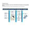  | Bachir, N., Harb, H., Zaki, C., Nabaa, M., Nys, G.-A., & Billen, R. (September 2023). PEMAP: An intelligence-based framework for post-event management of transportation systems. Computers and Electrical Engineering, 110, 108856. doi:10.1016/j.compeleceng.2023.108856 Peer Reviewed verified by ORBi |
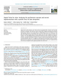 | Jeddoub, I., Nys, G.-A., Hajji, R., & Billen, R. (05 August 2023). Digital Twins for cities: Analyzing the gap between concepts and current implementations with a specific focus on data integration. International Journal of Applied Earth Observation and Geoinformation, 122, 103440. doi:10.1016/j.jag.2023.103440 Peer Reviewed verified by ORBi |
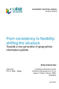 | Nys, G.-A. (2023). From consistency to flexibility: shifting the structure [Doctoral thesis, ULiège - Université de Liège]. ORBi-University of Liège. https://orbi.uliege.be/handle/2268/305813 |
 | Nys, G.-A., & Billen, R. (2022). From consistency to flexibility: Handling spatial information schema thanks to a middleware in a 3D city modeling context. Transactions in GIS. doi:10.1111/tgis.13014 Peer Reviewed verified by ORBi |
 | Yarroudh, A., Nys, G.-A., & Hajji, R. (2022). Modélisation 3D et développement d’une approche pour la structuration, le stockage et l’exploitation des infrastructures routières en 3D selon le standard CityGML 3.0 et son encodage CityJSON. |
 | Nys, G.-A. (06 September 2022). CityJSON at the Geomatics Unit : Research & Teaching [Paper presentation]. EnRHEd: Summer School 2022, Liège, Belgium. |
 | Nys, G.-A., Jeddoub, I., & Billen, R. (2022). "Digital Twins": an "academic" viewpoint [Paper presentation]. Smart Lunches. |
 | Van Ruymbeke, M., & Nys, G.-A. (2022). Voir ou être vu : analyses de visibilité depuis le site de Chèvremont (commune de Chaudfontaine, Belgique). Bulletin de la Société Géographique de Liège, 2022 (1), 147-156. doi:10.25518/0770-7576.6674 Peer Reviewed verified by ORBi |
 | Nys, G.-A., Dubois, C., Goffin, C., Hallot, P., Kasprzyk, J.-P., Treffer, M., & Billen, R. (2022). ÉVALUATION DE LA QUALITÉ DES GÉODONNÉES ET OPERATIONALISATION DE LA DIRECTIVE INSPIRE : RETOUR D'EXPERIENCE. BSGLg, 78 (1), 179 - 188. doi:10.25518/0770-7576.6698 Peer Reviewed verified by ORBi |
 | Nys, G.-A., & Billen, R. (2021). From consistency to flexibility: A simplified database schema for the management of CityJSON 3D city models. Transactions in GIS. doi:10.1111/tgis.12807 Peer Reviewed verified by ORBi |
 | Nys, G.-A. (06 July 2021). An extension of CityJSON for the support of point clouds [Paper presentation]. XXIV ISPRS Congress, Nice, France. |
 | Nys, G.-A., Kharroubi, A., Poux, F., & Billen, R. (30 June 2021). An extension of CityJSON to support point clouds. International Archives of the Photogrammetry, Remote Sensing and Spatial Information Sciences, XLII-B4-2021, 301-306. doi:10.5194/isprs-archives-XLIII-B4-2021-301-2021 Peer Reviewed verified by ORBi |
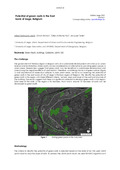 | Joshi, M. Y., Rohon, S., Nys, G.-A., & Teller, J. (30 March 2021). Potential of green roofs in the East bank of Liege, Belgium [Paper presentation]. EARSeL Joint Workshop 2021, Liege, Belgium, Belgium. |
 | El Yamani, S., Hajji, R., Nys, G.-A., Ettarid, M., & Billen, R. (05 March 2021). 3D Variables Requirements for Property Valuation Modeling Based on the Integration of BIM and CIM. Sustainability, 13 (2814). doi:10.3390/su13052814 Peer reviewed |
 | Kasprzyk, J.-P., Binard, M., Nys, G.-A., & Billen, R. (2020). Accessibilité des points de collecte de tests salivaires COVID-19 par les maisons de repos wallonnes. ULiège. |
 | Nys, G.-A. (27 October 2020). New OGC 3D standards in urban built environment [Paper presentation]. BeGeo 2020, Belgium. |
 | Nys, G.-A., & Billen, R. (22 September 2020). New 3D standards and perspectives [Paper presentation]. AM/FM Belux Webinars, Liège, Belgium. |
 | Nys, G.-A. (17 September 2020). Uliège activities related to CityJSON [Paper presentation]. 3DTalks, Delft, Netherlands. |
 | Nys, G.-A., Poux, F., & Billen, R. (31 August 2020). CityJSON Building Generation from Airborne LiDAR 3D Point Clouds. ISPRS International Journal of Geo-Information, 9 (521). doi:10.3390/ijgi9090521 Peer Reviewed verified by ORBi |
 | Nys, G.-A., Billen, R., & Poux, F. (2020). Automatic 3D Buildings Compact Reconstruction from LiDAR point clouds. International Archives of the Photogrammetry, Remote Sensing and Spatial Information Sciences, (XLIII-B2-2020), 473-478. doi:10.5194/isprs-archives-XLIII-B2-2020-473-2020 Peer Reviewed verified by ORBi |
 | Joshi, M., Selmi, W., Binard, M., Nys, G.-A., & Teller, J. (2020). Potential for urban greening with green roofs: A way towards smart cities. ISPRS Annals of the Photogrammetry, Remote Sensing and Spatial Information Sciences, VI-4 (W2-2020), 87–94. doi:10.5194/isprs-annals-VI-4-W2-2020-87-2020 Peer Reviewed verified by ORBi |
Orban, A., Barbier, C., Billen, R., Nys, G.-A., Kasprzyk, J.-P., Neyt, X., Stasolla, M., Beaumont, B., Tychon, B., & Wellens, J. (28 November 2019). EO_Regions_Science: Basic Research in support of EO_Regions! [Paper presentation]. Belgian Earth Observation Day (BEODay). |
 | Kasprzyk, J.-P., Nys, G.-A., & Billen, R. (18 October 2019). Integration of multiple sensor data into a 3D GIS for cities monitoring [Paper presentation]. Belgium Geographers Days, Ghent, Belgium. |
 | Nys, G.-A., Kasprzyk, J.-P., Hallot, P., & Billen, R. (13 June 2019). A Semantic Retrieval System for Remote Sensing Web Platforms [Paper presentation]. ISPRS GeoSpatial Week 2019, Enschede, Netherlands. |
 | Nys, G.-A., Kasprzyk, J.-P., Hallot, P., & Billen, R. (05 June 2019). A Semantic Retrieval System for Remote Sensing Web Platforms. International Archives of the Photogrammetry, Remote Sensing and Spatial Information Sciences, XLII-2 (W13), 1593-1599. doi:10.5194/isprs-archives-XLII-2-W13-1593-2019 Peer Reviewed verified by ORBi |
 | Nys, G.-A. (2019). GIS 3.0 : Towards a new generation of Geographic Information Systems [Paper presentation]. BeGeo 2019, Heysel, Brussels, Belgium. |
 | Nys, G.-A., Van Ruymbeke, M., & Billen, R. (13 October 2018). Spatio-temporal reasoning in CIDOC CRM: an hybrid ontology with GeoSPARQL and OWL-Time. CEUR Workshop Proceedings, 2230. Peer Reviewed verified by ORBi |
 | Nys, G.-A. (05 October 2018). Towards an Ontology for the Structuration of Remote Sensing Operations Shared by Different Processing Chains [Paper presentation]. ISPRS Technical Commission IV Symposium 2018, Delft, Netherlands. |
 | Nys, G.-A., Kasprzyk, J.-P., Hallot, P., & Billen, R. (19 September 2018). TOWARDS AN ONTOLOGY FOR THE STRUCTURING OF REMOTE SENSING OPERATIONS SHARED BY DIFFERENT PROCESSING CHAINS. International Archives of the Photogrammetry, Remote Sensing and Spatial Information Sciences, XLII (4), 483-490. doi:10.5194/isprs-archives-XLII-4-483-2018 Peer Reviewed verified by ORBi |
 | Poux, F., Neuville, R., Nys, G.-A., & Billen, R. (05 September 2018). 3D Point Cloud Semantic Modelling: Integrated Framework for Indoor Spaces and Furniture. Remote Sensing, 10 (9), 1412. doi:10.3390/rs10091412 Peer Reviewed verified by ORBi |
 | Billen, R., Jonlet, B., Luczfalvy Jancsó, A., Neuville, R., Nys, G.-A., Poux, F., Van Ruymbeke, M., Piavaux, M., & Hallot, P. (2018). La transition numérique dans le domaine du patrimoine bâti: un retour d'expériences. In Bulletin de la commission royale des monuments, sites et fouilles - Tome 30 (pp. 119-148). Commission royale des Monuments, Sites et Fouilles de la Région wallonne. |
Nys, G.-A., Van Ruymbeke, M., & Billen, R. (28 August 2018). Spatio-temporal reasoning in CIDOC CRM: an hybrid ontology with GeoSPARQL and OWL-Time [Paper presentation]. 2nd Workshop On Computing Techniques For Spatio-Temporal Data in Archaeology And Cultural Heritage, Melbourne, Australia. |
 | Van Ruymbeke, M., Hallot, P., Nys, G.-A., & Billen, R. (July 2018). Implementation of multiple interpretation data model concepts in CIDOC CRM and compatible models. Virtual Archaeology Review, 9 (19), 50-65. doi:10.4995/var.2018.8884 Peer Reviewed verified by ORBi |
 | Poux, F., Billen, R. (Other coll.), Hallot, P. (Other coll.), Luczfalvy Jancsó, A. (Other coll.), Neuville, R. (Other coll.), Nys, G.-A. (Other coll.), & Van Wersch, L. (Other coll.). (08 March 2018). Fusion de données lasergrammétriques/photogrammétriques et techniques d'extraction d'information archéologique sur base de nuage de points 3D [Paper presentation]. Patrimoine, modélisation numérique et systèmes d’acquisition d’informations : les enjeux actuels de la recherche, Lille, France. |
Orban, A., Barbier, C., Billen, R., Nys, G.-A., Kasprzyk, J.-P., Neyt, X., Stasolla, M., Tychon, B., & Wellens, J. (January 2018). EO_Regions_Science: Basic Research in support of EO_Regions! [Paper presentation]. Belgian Earth Observation Day (BEODay), Beersel, Belgium. |
 | Poux, F., Neuville, R., Van Wersch, L., Nys, G.-A., & Billen, R. (30 September 2017). 3D Point Clouds in Archaeology: Advances in Acquisition, Processing and Knowledge Integration Applied to Quasi-Planar Objects. Geosciences, 7 (4), 96. doi:10.3390/geosciences7040096 Peer Reviewed verified by ORBi |
Poux, F., Neuville, R., Kasprzyk, J.-P., Nys, G.-A., Hallot, P., Luczfalvy Jancsó, A., Jonlet, B., & Billen, R. (12 September 2017). LiDAR aérien et autres nuages de points pour la cartographie multi-échelles [Paper presentation]. Workshop LiDAR, Namur, Belgium. |
 | Nys, G.-A. (16 March 2017). Development of a prototype of errors prediction in a geodetic network [Paper presentation]. 2nd BeGeo, Brussels, Belgium. |
Nys, G.-A. (2016). Développement d'un prototype de prédiction de la précision d'un réseau géodésique [Master’s dissertation, Haute Ecole de la Province de Liège]. ORBi-University of Liège. https://orbi.uliege.be/handle/2268/212786 |