
Poux, F. (2024). 3D Deep Learning Course. (3D Geodata Academy, Toulouse, France, 3DDL-1 Develop End to End 3D Systems with 3D Deep Learning). Toulouse, France: 3D Geodata Academy. |
  | Ballouch, Z., Hajji, R., Kharroubi, A., Poux, F., & Billen, R. (2024). Investigating Prior-Level Fusion Approaches for Enriched Semantic Segmentation of Urban LiDAR Point Clouds. Remote Sensing, 16 (2), 329. doi:10.3390/rs16020329  Peer Reviewed verified by ORBi Peer Reviewed verified by ORBi |
 | Nurunnabi, A., Teferle, N., Balado, J., Chen, M., Poux, F., & Sun, C. (27 October 2022). ROBUST TECHNIQUES FOR BUILDING FOOTPRINT EXTRACTION IN AERIAL LASER SCANNING 3D POINT CLOUDS. International Archives of the Photogrammetry, Remote Sensing and Spatial Information Sciences, 48 (3), 43 - 50. doi:10.5194/isprs-archives-XLVIII-3-W2-2022-43-2022 Peer reviewed |
 | Kharroubi, A., Poux, F., Ballouch, Z., Hajji, R., & Billen, R. (17 October 2022). Three Dimensional Change Detection Using Point Clouds: A Review. Geomatics, 2 (4), 457-486. doi:10.3390/geomatics2040025 Peer reviewed |
 | Ballouch, Z., Hajji, R., Poux, F., Kharroubi, A., & Billen, R. (16 July 2022). A Prior Level Fusion Approach for the Semantic Segmentation of 3D Point Clouds Using Deep Learning. Remote Sensing, 14 (14), 3415. doi:10.3390/rs14143415 Peer Reviewed verified by ORBi |
  | Poux, F., Mattes, C., Selman, Z., & Kobbelt, L. (04 June 2022). Automatic region-growing system for the segmentation of large point clouds. Automation in Construction, 138, 104250. doi:10.1016/j.autcon.2022.104250 Peer Reviewed verified by ORBi |
 | Karara, G., Hajji, R., & Poux, F. (September 2021). 3D point cloud semantic augmentation: Instance segmentation of 360◦ panoramas by deep learning techniques. Remote Sensing, 13 (18), 3647. doi:10.3390/rs13183647 Peer Reviewed verified by ORBi |
 | Nys, G.-A., Kharroubi, A., Poux, F., & Billen, R. (30 June 2021). An extension of CityJSON to support point clouds. International Archives of the Photogrammetry, Remote Sensing and Spatial Information Sciences, XLII-B4-2021, 301-306. doi:10.5194/isprs-archives-XLIII-B4-2021-301-2021 Peer Reviewed verified by ORBi |
 | Kharroubi, A., Van Wersch, L., Billen, R., & Poux, F. (17 June 2021). TESSERAE3D: A benchmark for tesserae semantic segmentation in 3D point clouds. ISPRS Annals of the Photogrammetry, Remote Sensing and Spatial Information Sciences, V-2-2021, 121–128. doi:10.5194/isprs-annals-V-2-2021-121-2021 |
 | Poux, F. (2020). Expertise - Intégrer l’INTElligence artificielle dans les outils de suivi de l’environnement WalLOn [Paper presentation]. INTELLO, Liège, Belgium. |
 | Poux, F. (2020). How to automate LiDAR point cloud sub-sampling with Python. Towards Data Science. |
 | Poux, F. (05 November 2020). Extraction et Gestion Automatique de la sémantique dans les nuages de points [Paper presentation]. Conférence automatisation, relevés 3D et intelligence artificielle, Laval, Canada. |
 | Poux, F. (2020). Reconnaissance d'assets ferroviaires 3D [Paper presentation]. Reconnaissance ferroviaire, Bruxelles, Belgium. |
 | Poux, F. (20 October 2020). Nuages de points, segments, sémantique et automatisation [Paper presentation]. Chantier scientifique Notre-Dame - état des lieux et perspectives, Paris, France. |
 | Poux, F., Billen, R., Kasprzyk, J.-P., Lefebvre, P.-H., & Hallot, P. (07 October 2020). A Built Heritage Information System Based on Point Cloud Data: HIS-PC. ISPRS International Journal of Geo-Information, 9 (10), 588. doi:10.3390/ijgi9100588 Peer Reviewed verified by ORBi |
 | Poux, F., Mattes, C., & Kobbelt, L. (03 September 2020). Unsupervised segmentation of indoor 3D point cloud: application to object-based classification. International Archives of the Photogrammetry, Remote Sensing and Spatial Information Sciences, XLIV-4 (W1-2020), 111-118. doi:10.5194/isprs-archives-XLIV-4-W1-2020-111-2020 Peer Reviewed verified by ORBi |
 | Nys, G.-A., Poux, F., & Billen, R. (31 August 2020). CityJSON Building Generation from Airborne LiDAR 3D Point Clouds. ISPRS International Journal of Geo-Information, 9 (521). doi:10.3390/ijgi9090521 Peer Reviewed verified by ORBi |
 | Poux, F., & Ponciano, J.-J. (12 August 2020). SELF-LEARNING ONTOLOGY FOR INSTANCE SEGMENTATION OF 3D INDOOR POINT CLOUD. International Archives of the Photogrammetry, Remote Sensing and Spatial Information Sciences, XLIII (B2), 309–316. doi:10.5194/isprs-archives-XLIII-B2-2020-309-2020 Peer Reviewed verified by ORBi |
 | Kharroubi, A., Billen, R., & Poux, F. (12 August 2020). MARKER-LESS MOBILE AUGMENTED REALITY APPLICATION FOR MASSIVE 3D POINT CLOUDS AND SEMANTICS. International Archives of the Photogrammetry, Remote Sensing and Spatial Information Sciences, XLIII (B2), 255–261. doi:10.5194/isprs-archives-XLIII-B2-2020-255-2020 Peer Reviewed verified by ORBi |
 | Nys, G.-A., Billen, R., & Poux, F. (2020). Automatic 3D Buildings Compact Reconstruction from LiDAR point clouds. International Archives of the Photogrammetry, Remote Sensing and Spatial Information Sciences, (XLIII-B2-2020), 473-478. doi:10.5194/isprs-archives-XLIII-B2-2020-473-2020 Peer Reviewed verified by ORBi |
 | Poux, F., Valembois, Q., Mattes, C., Kobbelt, L., & Billen, R. (11 August 2020). Initial User-Centered Design of a Virtual Reality Heritage System: Applications for Digital Tourism. Remote Sensing, 12 (16), 2583. doi:10.3390/rs12162583 Peer Reviewed verified by ORBi |
 | Bassier, M., Vergauwen, M., & Poux, F. (11 July 2020). Point Cloud vs. Mesh Features for Building Interior Classification. Remote Sensing, 12 (14), 2224. doi:10.3390/rs12142224 Peer Reviewed verified by ORBi |
 | Poux, F. (2020). Fundamentals to clustering high-dimensional data (3D point clouds). Towards Data Science. |
 | Poux, F. (28 May 2020). Automatic extraction and management of semantics within point cloud data [Paper presentation]. NCG Point Clouds Seminar, Virtual Conference (Twente - TU Delft), Netherlands. |
 | Poux, F. (2020). How to represent 3D Data? Towards Data Science. Peer reviewed |
 | Poux, F. (2020). 5-Step Guide to generate 3D meshes from point clouds with Python. Towards Data Science. |
 | Poux, F. (2020). Discover 3D Point Cloud Processing with Python. Towards Data Science. |
 | Poux, F. (2020). The Future of 3D Point Clouds: a new perspective. Towards Data Science. |
 | Poux, F. (05 December 2019). The Smart Point Cloud Model: Integration of point intelligence [Paper presentation]. 2nd International Workshop on Point Cloud Processing, Stuttgart, Germany. |
 | Kharroubi, A., Hajji, R., Billen, R., & Poux, F. (29 November 2019). CLASSIFICATION AND INTEGRATION OF MASSIVE 3D POINTS CLOUDS IN A VIRTUAL REALITY (VR) ENVIRONMENT. International Archives of the Photogrammetry, Remote Sensing and Spatial Information Sciences, XLII-2 (W17), 165-171. doi:10.5194/isprs-archives-XLII-2-W17-165-2019 Peer Reviewed verified by ORBi |
 | Tabkha, A., Hajji, R., Billen, R., & Poux, F. (29 November 2019). Semantic enrichment of point cloud by automatic extraction and enhancement of 360° panoramas. International Archives of the Photogrammetry, Remote Sensing and Spatial Information Sciences, XLII-2 (W17), 355-362. doi:10.5194/isprs-archives-XLII-2-W17-355-2019 Peer Reviewed verified by ORBi |
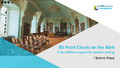 | Poux, F. (29 October 2019). 3D Point Clouds on the Web: A cost-efficient support for decision making [Paper presentation]. Plateformes numériques et patrimoines : quels apports pour la recherche et la médiation ?, Liège, Belgium. |
Poux, F., & Billen, R. (2019). Smart point clouds : Les dernières avancées en termes de structuration des nuages de points [Paper presentation]. GeoExpo, Ciney, Belgium. |
Poux, F., & Billen, R. (2019). A Smart Point Cloud Infrastructure for intelligent environments. In R. Lindenbergh & B. Riveiro-Rodríguez (Eds.), Laser scanning: an emerging technology in structural engineering (1st Edition, pp. 127-149). London, United Kingdom: CRC Press. doi:10.1201/9781351018869 Peer reviewed |
 | Poux, F. (2019). The Smart Point Cloud: Structuring 3D intelligent point data [Doctoral thesis, ULiège - Université de Liège]. ORBi-University of Liège. https://orbi.uliege.be/handle/2268/235520 |
 | Poux, F., & Billen, R. (07 May 2019). Voxel-Based 3D Point Cloud Semantic Segmentation: Unsupervised Geometric and Relationship Featuring vs Deep Learning Methods. ISPRS International Journal of Geo-Information, 8 (5), 213. doi:10.3390/IJGI8050213 Peer Reviewed verified by ORBi |
 | Neuville, R., Pouliot, J., Poux, F., & Billen, R. (23 January 2019). 3D Viewpoint Management and Navigation in Urban Planning: Application to the Exploratory Phase. Remote Sensing, 11 (3), 236. doi:10.3390/rs11030236 Peer Reviewed verified by ORBi |
 | Hallot, P., Poux, F., Neuville, R., & Billen, R. (18 October 2018). Utilisation des technologies d’acquisition 3D comme support à la compréhension matérielle de certains décors en partant du cas de l’oratoire de Germigny-des-Prés [Paper presentation]. Techniques, Décors et Patrimoine - Nécessités et limites d'intervention, Beez, Belgium. |
 | Poux, F., Neuville, R., Nys, G.-A., & Billen, R. (05 September 2018). 3D Point Cloud Semantic Modelling: Integrated Framework for Indoor Spaces and Furniture. Remote Sensing, 10 (9), 1412. doi:10.3390/rs10091412 Peer Reviewed verified by ORBi |
 | Billen, R., Jonlet, B., Luczfalvy Jancsó, A., Neuville, R., Nys, G.-A., Poux, F., Van Ruymbeke, M., Piavaux, M., & Hallot, P. (2018). La transition numérique dans le domaine du patrimoine bâti: un retour d'expériences. In Bulletin de la commission royale des monuments, sites et fouilles - Tome 30 (pp. 119-148). Commission royale des Monuments, Sites et Fouilles de la Région wallonne. |
 | Poux, F., & Hallot, P. (01 June 2018). Smart Point Clouds for information modelling: application in Cultural Heritage [Paper presentation]. Journées d’études "Le numérique : outil d’étude de la valeur patrimoniale !", Paris, France. |
 | Neuville, R., Pouliot, J., Poux, F., De Rudder, L., & Billen, R. (18 May 2018). A Formalized 3D Geovisualization Illustrated to Selectivity Purpose of Virtual 3D City Model. ISPRS International Journal of Geo-Information, 7 (5). doi:10.3390/ijgi7050194 Peer Reviewed verified by ORBi |
 | Poux, F., Billen, R. (Other coll.), Hallot, P. (Other coll.), Luczfalvy Jancsó, A. (Other coll.), Neuville, R. (Other coll.), Nys, G.-A. (Other coll.), & Van Wersch, L. (Other coll.). (08 March 2018). Fusion de données lasergrammétriques/photogrammétriques et techniques d'extraction d'information archéologique sur base de nuage de points 3D [Paper presentation]. Patrimoine, modélisation numérique et systèmes d’acquisition d’informations : les enjeux actuels de la recherche, Lille, France. |
 | Poux, F., Luczfalvy Jancsó, A. (Other coll.), Jonlet, B. (Other coll.), & Billen, R. (Other coll.). (08 March 2018). Numérisation 3D par lasergrammétrie et photogrammétrie: applications à la Réalité Virtuelle [Paper presentation]. Patrimoine, modélisation numérique et systèmes d’acquisition d’informations : les enjeux actuels de la recherche, Lille, France. |
Van Wersch, L., Hocquet, F.-P., Strivay, D., Poux, F., Billen, R., Kronz, A., Simon, K., Camerlynck, C., & Sapin, C. (2018). Recherches récentes sur le site de Germigny-des-Prés (Loiret, France) [Paper presentation]. Journées archéologiques de la Région Centre Val-de-Loire, Tours, France. |
 | Luczfalvy Jancsó, A., Hoffsummer, P., Billen, R., Jonlet, B., Hallot, P., & Poux, F. (2018). CASTLE4D : The Castle of Franchimont (Theux, Province of Liège, Belgium). In P. Ettel, A.-M. Flambard Héricher, ... K. O'Conor (Eds.), Château Gaillard 28 - L'environnement du château (pp. 191-195). Caen, France: Presses universitaires de Caen. |
 | Luczfalvy Jancsó, A., Jonlet, B., Hallot, P., Poux, F., Piavaux, M., & Billen, R. (2018). La cathédrale Saint-Paul de Liège : une méthodologie pour l’acquisition de données 3D. Bulletin du Centre de Recherches Archéologiques et Historiques de Normandie-Société Normande d'Etudes Préhistoriques. Hors-série, (1), 39-51. |
Van Wersch, L., Hocquet, F.-P., Strivay, D., Poux, F., Billen, R., Kronz, A., Simon, K., Camerlynck, C., & Sapin, C. (2018). The carolingian site of Germigny-des-Prés (Loiret, France), micro and macro-scales methods for the identification of a mosaic production [Poster presentation]. 42d Syposium of archaeometry, ISA 2018, Merida, Mexico. Peer reviewed |
Billen, R., Poux, F., & Van Ruymbeke, M. (02 November 2017). Smart Point Clouds for information modelling: application in Cultural Heritage [Paper presentation]. Annual Netherlands Centre for Geodesy and Geo-Informatics (NCG) Symposium, Delft, Netherlands. |
 | Poux, F., Neuville, R., Hallot, P., & Billen, R. (26 October 2017). MODEL FOR REASONING FROM SEMANTICALLY RICH POINT CLOUD DATA. ISPRS Annals of the Photogrammetry, Remote Sensing and Spatial Information Sciences, IV-4/W5, 107-115. doi:10.5194/isprs-annals-IV-4-W5-107-2017 Peer Reviewed verified by ORBi |
 | Neuville, R., Pouliot, J., Poux, F., Hallot, P., De Rudder, L., & Billen, R. (26 October 2017). TOWARDS A DECISION SUPPORT TOOL FOR 3D VISUALISATION: APPLICATION TO SELECTIVITY PURPOSE OF SINGLE OBJECT IN A 3D CITY SCENE. ISPRS Annals of the Photogrammetry, Remote Sensing and Spatial Information Sciences, IV-4/W5, 91-97. doi:10.5194/isprs-annals-IV-4-W5-91-2017 Peer Reviewed verified by ORBi |
 | Poux, F., Neuville, R., Van Wersch, L., Nys, G.-A., & Billen, R. (30 September 2017). 3D Point Clouds in Archaeology: Advances in Acquisition, Processing and Knowledge Integration Applied to Quasi-Planar Objects. Geosciences, 7 (4), 96. doi:10.3390/geosciences7040096 Peer Reviewed verified by ORBi |
Poux, F., Neuville, R., Kasprzyk, J.-P., Nys, G.-A., Hallot, P., Luczfalvy Jancsó, A., Jonlet, B., & Billen, R. (12 September 2017). LiDAR aérien et autres nuages de points pour la cartographie multi-échelles [Paper presentation]. Workshop LiDAR, Namur, Belgium. |
 | Poux, F., Neuville, R., Hallot, P., & Billen, R. (16 August 2017). POINT CLOUD CLASSIFICATION OF TESSERAE FROM TERRESTRIAL LASER DATA COMBINED WITH DENSE IMAGE MATCHING FOR ARCHAEOLOGICAL INFORMATION EXTRACTION. International Journal on Advances in Life Sciences, IV-2/W2, 203-211. doi:10.5194/isprs-annals-IV-2-W2-203-2017 Peer reviewed |
 | Poux, F., Neuville, R., Hallot, P., Van Wersch, L., Luczfalvy Jancsó, A., & Billen, R. (2017). DIGITAL INVESTIGATIONS OF AN ARCHAEOLOGICAL SMART POINT CLOUD: A REAL TIME WEB-BASED PLATFORM TO MANAGE THE VISUALISATION OF SEMANTICAL QUERIES. In Conservation of Cultural Heritage in the Digital Era (pp. 581-588). doi:10.5194/isprs-archives-XLII-5-W1-581-2017 Peer reviewed |
 | Poux, F., Neuville, R., Hallot, P., & Billen, R. (2016). Point Clouds as an Efficient Multiscale Layered Spatial Representation. In V. Tourre & F. Biljecki (Eds.), UDMV16: Eurographics Workshop on Urban Data Modelling and Visualisation. Geneve, Switzerland: The Eurographics Association. doi:10.2312/udmv.20161417 Peer reviewed |
 | Neuville, R., Poux, F., Hallot, P., & Billen, R. (05 October 2016). Towards a normalised 3D Geovisualisation : the viewpoint management. ISPRS Annals of the Photogrammetry, Remote Sensing and Spatial Information Sciences, IV-2 (W1), 179-186. doi:10.5194/isprs-annals-IV-2-W1-179-2016 Peer Reviewed verified by ORBi |
 | Poux, F., Neuville, R., Hallot, P., & Billen, R. (05 October 2016). SMART POINT CLOUD: DEFINITION AND REMAINING CHALLENGES. ISPRS Annals of the Photogrammetry, Remote Sensing and Spatial Information Sciences, IV-2 (W1), 119-127. doi:10.5194/isprs-annals-IV-2-W1-1-2016 Peer Reviewed verified by ORBi |
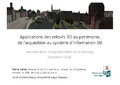 | Hallot, P., Billen, R., Poux, F., Van Ruymbeke, M., Neuville, R., & Luczfalvy Jancsó, A. (23 September 2016). Applications des relevés 3D au patrimoine, de l'acquisition au système d'information 3D [Paper presentation]. 13ème Journées de la Topographie - Données topographiques du futur : du numérique au virtuel. |
Luczfalvy Jancsó, A., Hoffsummer, P., Billen, R., Jonlet, B., Hallot, P., & Poux, F. (16 August 2016). CASTLE4D : The castle of Franchimont [Poster presentation]. Château Gaillard XXVIII - Castles and Landscapes, Roscommon, Ireland. |
 | Billen, R., Van Ruymbeke, M., Pfeiffer, M., Carré, C., Jonlet, B., Poux, F., Luczfalvy Jancsó, A., Neuville, R., & Hallot, P. (20 April 2016). Vers des systèmes d’information archéologique : maquette virtuelle et nuages de points intelligents [Paper presentation]. Maquettes et restitutions, Lille, France. |
Billen, R., Poux, F., Hallot, P., Jonlet, B., & Luczfalvy Jancsó, A. (17 February 2016). Le patrimoine en 3D : de l’acquisition aux nuages de points intelligents [Paper presentation]. 19ème conférence Patrimoine du master complémentaire en conservation et restauration du patrimoine culturel immobilier, Centre des métiers du patrimoine « la Paix Dieu », Amay, Belgium. |
 | Luczfalvy Jancsó, A., Billen, R., Hoffsummer, P., Jonlet, B., Hallot, P., & Poux, F. (2016). CASTLE4D: An Archaeological Information System Based on 3D Point Clouds. In J. L. Lerma & M. Cabrelles (Eds.), Proceedings of the Arqueológica 2.0 - 8th International Congress on Archaeology, Computer Graphics, Cultural Heritage and Innovation : Universitat Politècnica de València, Valence 5-7 septembre 2016 (pp. 247-252). València, Spain: Editorial Universitat Politècnica de València. doi:10.4995/arqueologica8.2016.4210 Peer reviewed |
 | Poux, F., & Billen, R. (17 December 2015). Smart point cloud: Toward an intelligent documentation of our world [Paper presentation]. The Professionnal Conference (PCON) 2015, Liège, Belgium. |
 | Novel, C., Keriven, R., Poux, F., & Graindorge, P. (25 November 2015). Comparing photogrammetry and laser scanning: a 3D reconstruction of the Castle of Penne [Paper presentation]. Capturing Reality Forum 2015, Salzburg, Austria. |
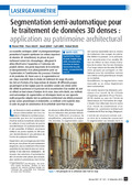 | Poux, F., Hallot, P., Jonlet, B., Carré, C., & Billen, R. (December 2014). Segmentation semi-automatique pour le traitement de données 3D denses : application au patrimoine architectural. XYZ: la Revue de l'Association Française de Topographie, 141 (36), 69-75. Peer reviewed |
Poux, F. (2014). Vers de nouvelles perspectives lasergrammétriques. Sarrebruck, Germany: EUE. |
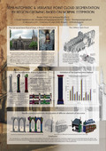 | Poux, F., & Billen, R. (06 September 2013). Semi-automatic and versatile point-cloud segmentation by region growing based on normal estimation [Poster presentation]. 14ème CIPA International Symposium, Strasbourg, France. |
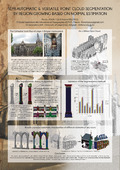 | Poux, F., & Billen, R. (02 September 2013). Recording, Documentation and Cooperation for Cultural Heritage [Poster presentation]. CIPA13, Strasbourg, France. |