Article for a general audience (Diverse speeches and writings)
How to automate LiDAR point cloud sub-sampling with Python
Poux, Florent
2020
 

Files


Full Text
TDS_automate_LiDAR_processing.pdf
Publisher postprint (1.7 MB)
Download

All documents in ORBi are protected by a user license.

Send to


Details


Keywords :
point cloud; 3D reconstruction; automation; clustering; sub-sampling; Feature Extraction
Abstract :
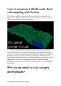
[en] In this article, I will give you my two favourite 3D processes for quickly structuring and sub-sampling point cloud data with python. You will also be able to automate, export, visualize and integrate results into your favourite 3D software, without any coding experience. I will focus on code optimization while using a minimum number of libraries (mainly NumPy) so that you can extend what you learnt with very high flexibility!
Disciplines :
Earth sciences & physical geography
Computer science
Author, co-author :
Poux, Florent  ;  Université de Liège - ULiège > Département de géographie > Unité de Géomatique - Topographie et géométrologie
Language :
English
Title :
How to automate LiDAR point cloud sub-sampling with Python
Alternative titles :
[en] How to automate LiDAR point cloud sub-sampling with Python
Publication date :
21 November 2020
Journal title :
Towards Data Science
Publisher :
Medium, New York, United States
Available on ORBi :
since 11 January 2021

Statistics


Number of views
353 (2 by ULiège)
Number of downloads
2342 (8 by ULiège)

Bibliography


Similar publications


Contact ORBi