Paper published in a journal (Scientific congresses and symposiums)
How to represent 3D Data?
Poux, Florent
2020In Towards Data Science
Peer reviewed
 

Files


Full Text
How to represent 3D data.pdf
Publisher postprint (5.52 MB)
Download

All documents in ORBi are protected by a user license.

Send to


Details


Keywords :
3D; Point Cloud; Data visualisation; Representation; Massive data; Mesh; BIM; Orthoimage; 3D Projection
Abstract :
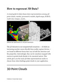
[en] The 3D datasets in our computerized ecosystem — of which an increasing number comes directly from reality capture devices — are found in different forms that vary in both the structure and the properties. Interestingly, they can be somehow mapped with success to point clouds thanks to its canonical nature. This article gives you the main 3D data representations modes to choose from when bindings point clouds to your application
Disciplines :
Engineering, computing & technology: Multidisciplinary, general & others
Earth sciences & physical geography
Computer science
Author, co-author :
Poux, Florent  ;  Université de Liège - ULiège > Département de géographie > Unité de Géomatique - Topographie et géométrologie
Language :
English
Title :
How to represent 3D Data?
Alternative titles :
[fr] Comment représenter des données 3D
Publication date :
11 May 2020
Event name :
Data Science Congress
Event date :
10 mai 2020
Audience :
International
Journal title :
Towards Data Science
Publisher :
Medium, New York, United States
Peer reviewed :
Peer reviewed
Available on ORBi :
since 09 June 2020

Statistics


Number of views
160 (15 by ULiège)
Number of downloads
833 (13 by ULiège)

Bibliography


Similar publications


Contact ORBi