[en] Field measurements in the ICOS program are spatially limited whereas the monitored gas fluxes may have a large footprint. Aerial remote sensing has the advantage to monitor large areas. The main goal of our research was to test the potential of unmanned aerial vehicles (UAV) to upscale parameters monitored through the ICOS program. In this study, we specifically focus on above-ground biomass (AGB) monitoring in a winter wheat crop.
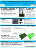
We used a octocopter drone (X frame type) to acquire a time series over the crop growing season (8 flights from the 14th of February 2017 to the 7th of July 2017) of multispectral imagery covering the ICOS candidate station of Lonzée (Wallonia, Belgium) and the surrounding field crop areas (ca. 0.25 km² per flight). The multispectral camera provides spectral information on the green (550 +/- 50 nm), red (660 +/- 50 nm), near infrared (735 +/- 50 nm) and red-edge (790 +/- 10 nm) wavelengths bands. The UAV also brought an off-the-shelf high resolution (20 Mpx) RGB camera to derive accurate 3D data.
We performed a photogrammetric 3D reconstruction of the acquired imagery for every flight survey. The images provided by the RGB sensor (Sony RX100) were used to produce a high spatial resolution Digital Surface Model (0.05 m) and the images acquired by the multispectral sensor were used to derive reflectance maps (0.1 m) in the four wavelengths bands. The four reflectance layers were combined to produce two straight-forward vegetation indices (Normalized Difference Vegetation Index and Green NDVI). The photogrammetric DSM’s were combined to a LiDAR Digital Terrain Model (public database, survey in winter 2013) to produce Crop Height Models (CHM) of the study area.
We used multiple linear regressions modelling in order to predict the AGB of the field crop monitored by the ICOS station of Lonzée with UAV imagery.
AGB=a+b*GNDVI+c*NDVI+d *CHM
The field crop data were provided by the ICOS program and by field research conducted in experimental field crops close to the flux tower. The field sampling consisted in destructive samples of the crop which were weighted after drying. For each field sample, an associated area was computed based on the outdistance sowing and the number of sampled crops in order to compute an AGB per area unit (t / Ha).
Each AGB field estimation was associated to the closest flight date to build a multi date model presenting good performances (r² = 0.85, RMSE = 2.3 t/Ha). We used the same modelling approach to adjust a single date model to derive a predicted AGB map for the 7th of July. The performance of the single date model is lower but still highlights the biomass variation within the crop (r² = 0.71, RMSE = 1.9 t/Ha). The predicted AGB map displays a high spatial heterogeneity with some spatial patterns. Locally low AGB values are found along two old pedestrian whereas higher AGB values can be associated to areas which were sprayed twice (in-between two tractor tracks).
Our results highlight the potential of UAV multispectral imagery to monitor the AGB variation within the footprint of the flux tower and highlight the need for repeated field sampling with a precise geolocation to improve the matching between the flight and the field surveys.
Disciplines :
Agriculture & agronomy
Author, co-author :
Michez, Adrien ; Université de Liège - ULiège > Ingénierie des biosystèmes (Biose) > Gestion des ressources forestières et des milieux naturels
Bauwens, Sébastien ; Université de Liège - ULiège > Ingénierie des biosystèmes (Biose) > Gestion des ressources forestières et des milieux naturels
Heinesch, Bernard ; Université de Liège - ULiège > Ingénierie des biosystèmes (Biose) > Biosystems Dynamics and Exchanges
Manise, Tanguy ; Université de Liège - ULiège > Agronomie, Bio-ingénierie et Chimie (AgroBioChem) > Ingénierie des productions végétales et valorisation
Mercatoris, Benoît ; Université de Liège - ULiège > TERRA Teaching and Research Center
Dumont, Benjamin ; Université de Liège - ULiège > Agronomie, Bio-ingénierie et Chimie (AgroBioChem) > Ingénierie des productions végétales et valorisation
Lejeune, Philippe ; Université de Liège - ULiège > Ingénierie des biosystèmes (Biose) > Gestion des ressources forestières et des milieux naturels
Language :
English
Title :
Upscaling winter wheat above-ground biomass measurements using multispectral imagery and 3D data from unmanned aerial vehicle
Alternative titles :
[fr] Accroissement spatial de la mesure de biomasse aérienne du blé d'hiver à l'aide d'un drone