Mass movements; Landslide susceptibility; spatial analysis; Cameroon Volcanic Line (CVL; GIS/Google Earth
Abstract :
[en] Landslides are recognized as important geomorphologic process due to the role they play in the development of hill slopes in mountainous regions, and to related socio-economic consequences. There are many causes of landslides and their distribution varies with the changing conditioning factors. Slope stability depends on a number of causative factors and the knowledge of these variables can help to predict the type of landslide expected in the future. In this study, past landslide activity and triggering factors will be used to assess mass movement hazards along the Cameroon Volcanic Line (CVL). Spatial aspects will be studied in terms of landslide susceptibility maps that are important for development planning and disaster management. The current synthesis of landslide susceptibility map at regional scale is based on a literature review to inventory passed mass movement impacts, on the detection of landslide features from Google Earth imagery, combined with spatial analysis using Geographical Information Systems (GIS) and remote sensing. One of the most critical stages in landslide susceptibility mapping is the selection of landslide pre-conditioning, conditioning and triggering factors and weighting of the selected causative factors in accordance to their influence on slope stability. Google earth helps for delineating past (but recent) and present landslide activity whereas GIS is suitable when deriving static factors (slope aspect and surface curvature) and time-dependent factors (annual precipitation and changing groundwater table level) that are needed to produce landslide susceptibility maps. Landslide susceptibility mapping is based on the assumption that future landslides will occur under similar circumstances as past and present mass movements. Different methods, including the weight of evidence methods, are used for landslide susceptibility mapping along the Cameroon Volcanic line, as the area is known to be highly susceptible to landslide occurrences.
Disciplines :
Earth sciences & physical geography
Author, co-author :
Mukenga, Williams ; Université de Liège - ULiège > Form. doct. sc. (géol. - paysage)
Havenith, Hans-Balder ; Université de Liège > Département de géologie > Géologie de l'environnement
Medjo Eko, Robert; University of Yaoundé I > Earth Sciences Department
Dewitte, Olivier; Musée royal de l'Afrique centrale > Earth Sciences Department
Language :
English
Title :
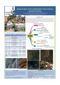
Spatial Analysis of the Landslide Risk in the Cameroon Volcanic Line (CVL)
Publication date :
12 May 2016
Number of pages :
A0
Event name :
STATE OF GEOMORPHOLOGICAL RESEARCH IN THE YEAR 2016