The University of Liège wishes to use cookies or trackers to store and access your personal data, to perform audience measurement. Some cookies are necessary for the website to function. Cookie policy.

  | Kharroubi, A., Remondino, F., Ballouch, Z., Hajji, R., & Billen, R. (06 April 2025). Semantic and Geometric Fusion for Object-Based 3D Change Detection in LiDAR Point Clouds. Remote Sensing, 17 (7), 1311. doi:10.3390/rs17071311  Peer Reviewed verified by ORBi Peer Reviewed verified by ORBi |
 | Rafamatanantsoa, B. P., Jeddoub, I., Yarroudh, A., Hajji, R., & Billen, R. (14 December 2024). City2Twin: an open urban digital twin from data integration to visualization and analysis. International Archives of the Photogrammetry, Remote Sensing and Spatial Information Sciences, XLVIII-2/W8-2024, 387-394. doi:10.5194/isprs-archives-xlviii-2-w8-2024-387-2024 Peer Reviewed verified by ORBi |
 | Doi, H., Yarroudh, A., Jeddoub, I., Hajji, R., & Billen, R. (14 December 2024). Automatic Detection and 3D Modeling of City Furniture Objects using LiDAR and Imagery Mobile Mapping Data. International Archives of the Photogrammetry, Remote Sensing and Spatial Information Sciences, XLVIII-2/W8-2024, 125-132. doi:10.5194/isprs-archives-xlviii-2-w8-2024-125-2024 Peer Reviewed verified by ORBi |
 | Doi, H., Yarroudh, A., Jeddoub, I., Hajji, R., & Billen, R. (12 December 2024). [Presentation] Automatic Detection and 3D Modeling of City Furniture Objects using LiDAR and Imagery Mobile Mapping Data [Paper presentation]. Low-Cost 3D workshop, Brescia, Italy. |
 | Jeddoub, I., Nys, G.-A., Hajji, R., & Billen, R. (2024). Data integration across urban digital twin lifecycle: a comprehensive review of current initiatives. Annals of GIS, 1-20. doi:10.1080/19475683.2024.2416135 Peer Reviewed verified by ORBi |
 | Ballouch, Z., Jeddoub, I., Hajji, R., Kasprzyk, J.-P., & Billen, R. (31 May 2024). Towards a Digital Twin of Liege: The Core 3D Model based on Semantic Segmentation and Automated Modeling of LiDAR Point Clouds. ISPRS Annals of the Photogrammetry, Remote Sensing and Spatial Information Sciences, X-4/W4-2024, 13-20. doi:10.5194/isprs-annals-x-4-w4-2024-13-2024 Peer Reviewed verified by ORBi |
 | Kharroubi, A., Ballouch, Z., Hajji, R., Yarroudh, A., & Billen, R. (09 April 2024). Multi-Context Point Cloud Dataset and Machine Learning for Railway Semantic Segmentation. Infrastructures, 9 (4), 71. doi:10.3390/infrastructures9040071 Peer Reviewed verified by ORBi Dataset: https://github.com/akharroubi/Rail3D Dataset: https://github.com/akharroubi/Rail3D |
 | Tamort, A., Kharroubi, A., Hajji, R., & Billen, R. (08 March 2024). 3D CHANGE DETECTION FOR SEMI-AUTOMATIC UPDATE OF BUILDINGS IN 3D CITY MODELS. International Archives of the Photogrammetry, Remote Sensing and Spatial Information Sciences, XLVIII-4/W9-2024, 349-355. doi:10.5194/isprs-archives-xlviii-4-w9-2024-349-2024 Peer Reviewed verified by ORBi |
 | Jeddoub, I.* , Ballouch, Z.* , Hajji, R., & Billen, R. (2024). Enriched Semantic 3D Point Clouds: An Alternative to 3D City Models for Digital Twin for Cities? In T. H. Kolbe, A. Donaubauer, ... C. Beil (Eds.), Recent Advances in 3D Geoinformation Science - Proceedings of the 18th 3D GeoInfo Conference. Springer Science and Business Media Deutschland GmbH. doi:10.1007/978-3-031-43699-4_26 Peer reviewed* These authors have contributed equally to this work. |
 | Kharroubi, A., Ballouch, Z., Jeddoub, I., Hajji, R., & Billen, R. (2024). Automated detection and structuration of building and vegetation changes from LiDAR point clouds. International Archives of the Photogrammetry, Remote Sensing and Spatial Information Sciences, XLVIII-2/W8-2024, 227-233. doi:10.5194/isprs-archives-XLVIII-2-W8-2024-227-2024 Peer Reviewed verified by ORBi |
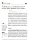 | Ballouch, Z., Hajji, R., Kharroubi, A., Poux, F., & Billen, R. (2024). Investigating Prior-Level Fusion Approaches for Enriched Semantic Segmentation of Urban LiDAR Point Clouds. Remote Sensing, 16 (2), 329. doi:10.3390/rs16020329 Peer Reviewed verified by ORBi |
 | Yarroudh, A., Nys, G.-A., & Hajji, R. (13 December 2023). 3D MODELING OF ROAD INFRASTRUCTURES ACCORDING TO CITYGML 3.0 AND ITS CITYJSON ENCODING. International Archives of the Photogrammetry, Remote Sensing and Spatial Information Sciences, XLVIII-1/W2-2023, 63-70. doi:10.5194/isprs-archives-xlviii-1-w2-2023-63-2023 Peer Reviewed verified by ORBi |
 | Jeddoub, I., Nys, G.-A., Hajji, R., & Billen, R. (05 August 2023). Digital Twins for cities: Analyzing the gap between concepts and current implementations with a specific focus on data integration. International Journal of Applied Earth Observation and Geoinformation, 122, 103440. doi:10.1016/j.jag.2023.103440 Peer Reviewed verified by ORBi |
 | El Barhoumi, N., Hajji, R., Bouali, Z., Ben Brahim, Y., & Kharroubi, A. (20 October 2022). Assessment of 3D Models Placement Methods in Augmented Reality. Applied Sciences, 12 (20), 10620. doi:10.3390/app122010620 Peer Reviewed verified by ORBi |
 | Kharroubi, A., Poux, F., Ballouch, Z., Hajji, R., & Billen, R. (17 October 2022). Three Dimensional Change Detection Using Point Clouds: A Review. Geomatics, 2 (4), 457-486. doi:10.3390/geomatics2040025 Peer reviewed |
 | Ballouch, Z., Hajji, R., Poux, F., Kharroubi, A., & Billen, R. (16 July 2022). A Prior Level Fusion Approach for the Semantic Segmentation of 3D Point Clouds Using Deep Learning. Remote Sensing, 14 (14), 3415. doi:10.3390/rs14143415 Peer Reviewed verified by ORBi |
 | Hajji, R. (2013). Vers une méthode de conception de SIG 3D collaboratif [Doctoral thesis, ULiège - Université de Liège]. ORBi-University of Liège. https://orbi.uliege.be/handle/2268/156447 |
