orthorectification; VHR image; Digital Surface Model (DSM); Liège; THR image; Modèle numérique de surface (MNS); Portail Cartographique de la Région wallonne
Abstract :
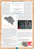
[en] This paper presents the first results of the SPIDER project obtained on a VHR satellite image (QuickBird) acquired on the Liège area (315 km²). It shows how a selection of data in the Walloon cartographic gateway allowed the making of a DSM needed at the orthorectification of the satellite image. [fr] Cet article présente les premiers résultats du projet SPIDER obtenus sur une image satellite THR (QuickBird) acquise sur la région liégeoise et couvrant 315 km². Il montre comment une sélection de données de la base de données du portail cartographique de la Région wallonne a permis d’obtenir un DSM nécessaire à la production d’une orthoimage.
Research Center/Unit :
Laboratoire SURFACES
Disciplines :
Earth sciences & physical geography
Author, co-author :
Binard, Marc ; Université de Liège - ULiège > Département de géographie > Labo Surfaces - Unité de Géomatique - Geomatics Unit
Language :
French
Title :
Usage des données 3D IGN, PICC et SETHY pour l’orthorectification d’une image QuickBird en région liégeoise.