Abstract :
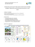
[en] Urban planning must increasingly integrate air quality considerations in alignment with Sustainable Development Goal 11. However, existing tools for assessing the impact of urban developments on air quality are either technically demanding or dependent on post-construction measurements. This study presents the finalization, validation, and application of a spatially explicit air quality index based on proxy data. The index aggregates five normalized parameters—topography, roads, buildings, vegetation, and external sources—into a single annual score ranging from 0 (excellent) to 5 (very poor) on a 300 m grid. A novel reference value (RV), combining the BelAQI index and total VOC concentrations, was used to calibrate index thresholds via regression and percentile optimization. Validation on eight monitoring sites yielded a 75% agreement rate with the RV classification. The index was then applied to the city of Seraing, Belgium, revealing a slight decrease in structural pressure on air quality over two decades despite significant urban changes, while remaining in the highest impact class. It offers a low-cost, accessible decision-support tool for municipalities, providing preemptive insight into the air quality impacts of land use planning. It stands as a complementary indicator to traditional air quality metrics, with strong potential for adaptation and future refinement
Disciplines :
Physical, chemical, mathematical & earth Sciences: Multidisciplinary, general & others
Scopus citations®
without self-citations
0