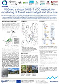
Abstract :
[en] Climatological, meteorological and hydrological extreme events, in particular droughts, are expected to become more frequent and severe under current and future climate change. These events translate into increased pressure on forest and individual tree water budgets, and consequentially increased mortality. In the domain of space-borne microwave remote sensing, vegetation can be characterized by the vegetation optical depth (VOD), a parameter that describes the attenuation effects of vegetation for electromagnetic waves, frequently used in parameter retrieval models in the microwave domain. VOD is related to the water content, structure and biomass of vegetation and has been used successfully to study water status and biomass globally from satellite-based retrievals. Ground based observations from radiometers or scatterometers that could be used to validate space-borne retrieved VOD (e.g. from ESA’s upcoming HydroGNSS Scout mission), however, are rare and costly, which renders VOD tedious to validate from independent microwave measurements across different forest ecosystems. GNSS-T (global navigation satellite system transmissometry) is an opportunistic exploitation of GNSS signals (L-band, 1-2 GHz) with permanently installed antennas. Incoming signals from the 20-40 individual GNSS satellites – in view at any particular point in time from the four main constellations (GLONASS, GPS, GALILEO, BeiDou) – are partially/gradually attenuated by the forest canopy. The comparison of the transmitted signal received by a ground antenna against a reference antenna with clear sky view yields canopy-only attenuation, hence VOD. Pilot studies have already shown its use for monitoring vegetation water content, evapotranspiration and intercepted rainfall at high temporal resolution and its relation to biomass and phenology. A coordinated effort for joint but distributed observations would greatly benefit our understanding of microwave transmission in forest ecosystems, deducing state and flux estimations, and calibrating as well as validating space-borne VOD data sets. In analogy to soil moisture networks (e.g., International Soil Moisture Network, https://ismn.earth/en/), a similar network of VOD ground-based observations would greatly compare to space-borne VOD retrievals as well as validation and strengthen their application for global drought studies. This contribution introduces the VODnet initiative. An overview of the different observation sites and site setups across a gradient of bioclimatological conditions ranging from temperate to tropical forests in Europe, North America, and South America will be presented. Hardware and software of the individual partners will be shown, and interoperability of these partnering subnets discussed. Current research objectives of the individual partners are presented, including challenges of data interpretation, and inter-comparisons with complementary in situ and remote sensing observations. Finally, an outlook on network coverage and use cases will be presented, in particular the interoperability with other networks (sapfluxnet & Ameriflux) and their data streams, such as energy and carbon fluxes observed by Eddy Covariance towers.