Login
EN
[EN] English
[FR] Français
Login
EN
[EN] English
[FR] Français
Give us feedback
Explore
Search
Special collections
Statistics
News
Help
Start on ORBi
Deposit
Profile
Publication List
Add your ORCID
FAQ: FWB Open Access Decree
Tutorials
Legal Information
Training sessions
About
What's ORBi ?
Impact and visibility
Around ORBi
About statistics
About metrics
OAI-PMH
ORBi team
Release Notes
Back
Home
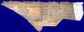
Carte 3D des murs supportant les entraits de l'église St Jean, Collégiale d'Amay et Abbaye de Floreffe, Belgique - 2012
Download
Single work (Cartographic materials)
Carte 3D des murs supportant les entraits de l'église St Jean, Collégiale d'Amay et Abbaye de Floreffe, Belgique
Hallot, Pierre
;
Schenke, Christophe
;
Billen, Roland
2012
Permalink
https://hdl.handle.net/2268/198814
Files (1)
Send to
Details
Statistics
Bibliography
Similar publications
Files
Full Text
Ortho_Floreffe.tif
Publisher postprint (32.2 MB)
Version de taille réduite, contacter l'auteur pour une version originale
Download
All documents in ORBi are protected by a
user license
.
Send to
RIS
BibTex
APA
Chicago
Permalink
X
Linkedin
copy to clipboard
copied
Details
Keywords :
3D Map; pointcloud; orthoimage
Abstract :
[fr]
Relevé 3D et génération d'orthoimages de murs supportant les entraits des charpentes des églises St Jean, Amay et Floreffe, Belgique.
Precision for document type :
Orthophotoplan/orthophotomap
Disciplines :
Architecture
Earth sciences & physical geography
Archaeology
Author, co-author :
Hallot, Pierre
;
Université de Liège > Département de géographie > Unité de Géomatique - Topographie et géométrologie
Schenke, Christophe
Billen, Roland
;
Université de Liège > Département de géographie > Unité de Géomatique - Topographie et géométrologie
Language :
French
Title :
Carte 3D des murs supportant les entraits de l'église St Jean, Collégiale d'Amay et Abbaye de Floreffe, Belgique
Alternative titles :
[en]
3D Map of the walls supporting the frame structure of the churches St Jean, Amay and Floreffe, Belgium
Publication date :
2012
Publisher :
ULg
Map type :
Orthophotoplan - Carte 3D
Format (dimensions, colours) :
3 plans, couleur, numérique, résolution 3mm
Scale :
1/1
Available on ORBi :
since 22 June 2016
Statistics
Number of views
198 (17 by ULiège)
Number of downloads
59 (12 by ULiège)
More statistics
Bibliography
Similar publications
Contact ORBi