Training image; multiple-point statistics; multidimensional scaling; electrical resistivity
Abstract :
[en] Recently, multiple-point statistics (MPS) introduced the training image (TI) concept to replace the variogram within an extended sequential simulation in order to describe more accurately multimodal distributions, with interconnected and curvilinear structures, such as those of alluvial plains. The role of the TI is to depict the conceptual geological patterns and it should be representative of the geological heterogeneity. MPS consists in extracting patterns from the training image, and anchoring them to subsurface data (e.g. well-log, seismic and production data). The construction of TI is one of the most critical and important step of MPS. Sedimentological studies may not be always available in a particular area. In this work, the alluvial aquifer of the Meuse river in the area of Liege is being investigated and there is few sedimentological data to build directly 3D conceptual model of the aquifer.
In this context, we used general features of the Meuse river (slope, rate of flow, type of fluvial system) to select hydrofacies (based on a lithological classification in clay, sand and gravel) and their geometrical characteristics (channels and lobes of different sizes). Then several scenarios were built using these parameters to represent the uncertainty related to different possible geological scenarios. To verify the consistency of these TIs, a comparison with 2D electrical resistivity tomography data was carried out. 2D sections were randomly selected in the TIs and several cases were analyzed including the size of channels and lobes, the influence of surface resistivity in the results and the influence of the electrical resistivity of each facies. Forward and inverse electrical resistivity modelling was conducted on these synthetic models and the results were compared to field cases. The approach followed for the comparison is based on the calculation of a Euclidean distance between models and the visualization in a 2D or 3D space using multidimensional scaling (MDS). This technique allows verifying if field cases fall in the distribution represented by synthetic cases. In a second step, a cluster analysis was achieved on the MDS-map to provide a sensitivity analysis and to highlight which parameters were the most important for building training images. Then, the probability of each scenario was evaluated for the field cases using conditional probability. Conditional probability requires the calculation of the density function corresponding to the probability of the data given a geological scenario. This density function was obtained using a kernel density estimation technique based on the observations of the 2D MDS-map.
Both the cluster analysis and the calculation of conditional probabilities for uncertain geological scenarios show that some parameters are not very sensitive (size of clay lenses, surface resistivity distribution) and that we can narrow the range of variations of some parameters (facies electrical resistivity values, gravel bodies size is more likely small, etc.). It shows that the investigation of the consistency of TI is an important step in each study including MPS. The next steps of the study are to generalize the analysis of the consistency of geological scenario with 3D geophysical data instead of 2D sections and to incorporate geophysical data as soft conditioning data for MPS simulations.
Research Center/Unit :
Stanford Center for reservoir Forecasting
Disciplines :
Geological, petroleum & mining engineering
Author, co-author :
Hermans, Thomas ; Université de Liège - ULiège > Département Argenco : Secteur GEO3 > Géophysique appliquée
Caers, Jef; Stanford University > Energy Resources Engineering > Stanford Center for Reservoir Forecasting
Nguyen, Frédéric ; Université de Liège - ULiège > Département Argenco : Secteur GEO3 > Géophysique appliquée
Language :
English
Title :
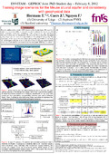
Training image scenarios for the Meuse alluvial aquifer and consistency with geophysical data
Alternative titles :
[fr] Scénarios d'image d'entrainement pour l'aquifère alluvial de la Meuse et consistance avec des données géophysiques
Publication date :
08 February 2012
Number of pages :
A0 Portrait
Event name :
ENVITAM - GEPROC Joint PhD-Student day
Event organizer :
ENVITAM and GEPROC Doctoral Schools
Event place :
Gembloux, Belgium
Event date :
le 8 février 2012
Funders :
F.R.S.-FNRS - Fonds de la Recherche Scientifique ULiège. Patrimoine - Université de Liège. Patrimoine Fondation Louise Gillet (Ulg)