field validation; georeferencing; ground-level dataset; field monitoring; UHI; heat in city; mortality; characterization; remote sensing; data fusion
Abstract :
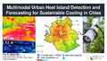
[en] This keynote explores advanced multimodal approaches for detecting and forecasting Urban Heat Islands (UHIs) by combining satellite-based land surface temperature (LST) analysis, ground monitoring, and urban microclimate modeling. We will examine the integration of remote sensing with in-situ data and simulation tools to improve UHI detection and interpretation. The lecture also presents recent advancements in image-based analysis and the use of machine learning algorithms for automated UHI pattern recognition and predictive forecasting. Special attention is given to the objectives of the newly launched IEA EBC Annex on Sustainable Cooling in Cities and its role in supporting evidence-based UHI mitigation.
Disciplines :
Architecture
Author, co-author :
Attia, Shady ; Université de Liège - ULiège > Urban and Environmental Engineering
Language :
English
Title :
[Keynote] Multimodal Urban Heat Island Detection and Forecasting for Sustainable Cooling in Cities
Publication date :
31 May 2025
Number of pages :
30
Event name :
International Conference on Urban Climate and Urban Design
Event organizer :
Chongqing University
Event place :
Chongqing, China
Event date :
31.05.2025
Event number :
5
Audience :
International
Development Goals :
11. Sustainable cities and communities 3. Good health and well-being 13. Climate action