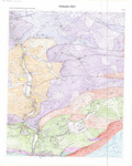
[en] New geological map of Wallonia that will be published at the scale of 1/25.000, based onnew field works and using previous scientific data produced, since the first edition published in 1901 (Maximin Lohest & Henri Forir) on the name Vielsalm-Houvegnez, at the scale of 1/40,000 by the "Commission Géologique de Belgique". First complete edition; the former one stopped at the border between Belgium and Prussia.
Research Center/Unit :
Evolution and Diversity Dynamics (EDDy) Lab, ULiège
Precision for document type :
Map
Disciplines :
Earth sciences & physical geography
Author, co-author :
Marion, Jean-Marc ; Université de Liège - ULiège > Département de Géologie > Evolution and Diversity Dynamics (EDDy) Lab
Geukens, Fernand; Katholieke Universiteit Leuven - KUL (Professeur Emerite)
Lamberty, Pauline
Language :
French
Title :
Vielsalm - Recht. Carte géologique de Wallonie. 55/1-2
Alternative titles :
[en] Vielsalm - Recht. Geological map of Wallonia (Belgium). 55/1-2
Publication date :
2019
Publisher :
SPW/Editions, Cartes, Namur (Jambes), Belgium
Edition :
Révision et 1ère édition complète
Collection name :
Carte géologique de la Wallonie à l'échelle 1:25.000. Carte. 50/5-6
Map type :
Carte géologique (lithostratigraphique) sur fond topographique
Review date :
2018-2019
Update date :
2019
Other date :
documents manuscrits déposés au SPW/DGO3/Service géologique de Wallonie le 12/06/2019
Format (dimensions, colours) :
1 carte à l'échelle 1:10.000, sur 2 feuilles, couleurs, (2x) 80x100
Scale :
1:10.000 (manuscrits. Publication à l'échelle 1:25.000)
Geographical coordinates :
E05°53'17"-E06°06'46"/ N50°21'44"-N50°16'15"
Geographic area :
Wallonie (est), Belgique
Date/time boundaries :
Compilation de données nouvelles et anciennes* (*cartes et données des 19ème, 20ème et 21ème siècles)
Programme de révision de la carte géologique de Wallonie. Recherches collectives d'intérêt général.
Funders :
SPW DG03-DGARNE - Service Public de Wallonie. Direction Générale Opérationnelle Agriculture, Ressources naturelles et Environnement
Commentary :
See also the URL of the hydrogeologic map of Wallonia at the scale of 1/25.000 (Briers, Gilson, & Ruthy, 2012), enhanced in 2017 (Bouezmarni & Hanson, 2017)