[en] The spatial interpolation of along-track Sea-Level Anomalies (SLA) data to produce gridded map has numerous applications in oceanography (model validation, data assimilation, eddy tracking, ...). Optimal Interpolation (OI) is often the preferred method for this task, as it leads to the lowest expected error and provides an error field associated to the analyzed field. However, the method suffers from limitations such as the numerical cost (due to the inversion of covariance matrices) as well as the isotropic covariance function, generally employed in altimetry.
The Data-Interpolating Variational Analysis (DIVA) is a gridding method based on the minimization of a cost function using a finite-element technique. The cost function penalizes the departures from observations, the smoothness of the gridded field and physical constraints (advection, diffusion, ...). It has been shown that DIVA and OI are equivalent (provided some assumptions on the covariances are made), the main difference is that in DIVA, the covariance function is not explicitly formulated. The technique has been previously applied for the creation of regional hydrographic climatologies, which required the processing of a large number of data points.
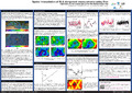
In this work we present the application and adaptation of Diva to the analysis of SLA in the Mediterranean Sea and the production of weekly maps of SLA in this region. The peculiarities of SLA along-track data are addressed: • number of observations: the finite-element technique coupled to improvements in the matrix inversion (parallel or iterative solvers) lead to a decrease of the computational time, meaning that sub-sampling of the initial data set is not required.
• quality of the different missions: the weight attributed to each data point can be easily set according to the satellite that provided the observations, so that different measurement noise variances are considered.
• spatial correlation scale: it varies spatially in the domain according to the value of the Rossby radius of deformation.
• long-wavelength errors: each data point is associated a class, and a detrending technique allows the determination of the trend for each class, leading to a reduction of the inconsistencies between missions.
• anisotropy of physical coastal features: a pseudo-velocity field derived from regional bathymetry enhances the correlations along the main currents. Particular attention will be paid to the influence of this constraint in the coastal area. The analysis and error fields obtained over the Mediterranean Sea are compared with the available gridded products from AVISO. Different ways to compute the error field are compared. The impact of the use of multiple missions to prepare the gridded fields is also examined. In situ measurements from an intensive multi-sensor experiment carried out north of the Balearic Islands in May 2009 serve to assess the quality of the gridded fields in the coastal area.
Research Center/Unit :
MARE - Centre Interfacultaire de Recherches en Océanologie - ULiège IMEDEA - Marine Technologies, Operational Oceanography and Sustainability
Disciplines :
Earth sciences & physical geography
Author, co-author :
Troupin, Charles ; Université de Liège - ULiège > Département d'astrophys., géophysique et océanographie (AGO) > GeoHydrodynamics and Environment Research (GHER)
Barth, Alexander ; Université de Liège - ULiège > Département d'astrophys., géophysique et océanographie (AGO) > GeoHydrodynamics and Environment Research (GHER)
Beckers, Jean-Marie ; Université de Liège - ULiège > Département d'astrophys., géophysique et océanographie (AGO) > GeoHydrodynamics and Environment Research (GHER)
Pascual, Ananda; Mediterranean Institute for Advanced Studies > Marine Technologies, Operational Oceanography and Sustainability
Language :
English
Title :
Interpolation of SLA Using the Data-Interpolating Variational Analysis in the Coastal Area of the NW Mediterranean Sea
Publication date :
07 October 2013
Number of pages :
A0
Event name :
Coastal Altimetry Workshop
Event organizer :
European Space Agency
Event place :
Boulder, United States
Event date :
from 07-10-2013 to 08-10-2013
Audience :
International
European Projects :
FP7 - 283607 - SEADATANET II - SeaDataNet II: Pan-European infrastructure for ocean and marine data management
Name of the research project :
SeaDataNet II
Funders :
F.R.S.-FNRS - Fonds de la Recherche Scientifique UE - Union Européenne CE - Commission Européenne