Hydrological instrumentation of a pilot catchment in view to improve the soil loss modeling: focus on the spatial distribution of erosion and deposition (loamy region, Belgium) - 2012
Hydrological instrumentation of a pilot catchment in view to improve the soil loss modeling: focus on the spatial distribution of erosion and deposition (loamy region, Belgium)
Pineux, Nathalie; Degré, Aurore
2012 • 4th International Congress EUROSOIL 2012, Soil Science for the Benefit for the Mankind and Environment
[en] Nowadays, lots of catchments are affected by inundations or mudflows which are the consequences of excessive runoff and accelerated erosion. That generates also a significant loss of arable land. Yet, the soil resource is not an unlimited commodity. Moreover, sediments’ transfer to watercourses alters their physical and chemical quality. The watershed management should aim at both limiting erosion and enhancing deposition in appropriate zones.
Therefore, the global objective of this work is to acquire hydropedological data in order to better quantify the erosion and deposition phenomenon in Belgium. The poster presents the field monitoring put in place in our experimental watershed. Indeed, observed quantitative data are essential but still limited. Particularly, we lack observations spatially distributed on the watershed.
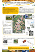
The watershed is a 124 ha agricultural zone in the loamy region. Its slopes range from 0% to 9%. Instrumentation includes a weather station with disdrometer, discharge measurement at the outlet coupled with water sampling. Fields observations are done to determine the texture redistribution and compared with a previous soil survey realised in 1958. Moreover, regular flights above the area will allow us to obtain a very accurate DEM using Lidar technology (5cm pixel) and observing the relief evolution.
The CAESAR model will be tested on this watershed. It aims at representing both erosion and sedimentation and estimates the net erosive flows. This model is based on the Einstein-Brown equations and needs an initial digital elevation model, hourly rainfalls, soil texture, etc. It produces a digital elevation models’ evolution through time.
Pineux, Nathalie ; Université de Liège - ULiège > Sciences et technologie de l'environnement > Hydrologie et hydraulique agricole
Degré, Aurore ; Université de Liège - ULiège > Sciences et technologie de l'environnement > Hydrologie et hydraulique agricole
Language :
English
Title :
Hydrological instrumentation of a pilot catchment in view to improve the soil loss modeling: focus on the spatial distribution of erosion and deposition (loamy region, Belgium)
Publication date :
02 July 2012
Number of pages :
A0
Event name :
4th International Congress EUROSOIL 2012, Soil Science for the Benefit for the Mankind and Environment
Event organizer :
EUROPEAN CONFEDERATION OF SOIL SCIENCE SOCIETIES (ECSSS)