

  | Plisnier, P.-D., Cocquyt, C., Cornet, Y., Poncelet, N., Nshombo, M., Ntakimazi, G., Nahimana, D., Makasa, L., & MacIntyre, S. (2023). Phytoplankton blooms and fish kills in lake Tanganyika related to upwelling and the limnological cycle. Journal of Great Lakes Research, 102247. doi:10.1016/j.jglr.2023.102247  Peer Reviewed verified by ORBi Peer Reviewed verified by ORBi |
 | Damseaux, A., Fettweis, X., Lambert, M., & Cornet, Y. (2019). Representation of the rain shadow effect in Patagonia using an orographic‐derived regional climate model. International Journal of Climatology. doi:10.1002/joc.6300 Peer Reviewed verified by ORBi |
 | Billen, R., Binard, M., Cornet, Y., Hallot, P., Kasprzyk, J.-P., Warnant, R., & Sheeren, D. (2019). Un regard sur l’évolution de la géomatique : analyse de 4 décennies de recherche au sein du Département de Géographie de l’Université de Liège. Bulletin de la Société Géographique de Liège, (72), 11-32. Peer Reviewed verified by ORBi |
  | Cornet, Y. (09 May 2016). Les outils géomatiques dans le projet ExTraCar [Paper presentation]. Colloque ExTraCar du 9 mai 2016, Palais des Congrès, Liège, Liège, Belgium. |
 | Van de Voorde, T., van der Kwast, J., Poelmans, L., Canters, F., Binard, M., Cornet, Y., Engelen, G., Uljee, I., Shahumyan, H., Williams, B., Convery, S., & Lavalle, C. (January 2016). Projecting alternative urban growth patterns: The development and application of a remote sensing assisted calibration framework for the Greater Dublin Area. Ecological Indicators, 60, 1056–1069. doi:10.1016/j.ecolind.2015.08.035 Peer Reviewed verified by ORBi |
 | Cornet, Y. (14 November 2015). Du satellite au terrain. Observation de la surface terrestre et processus géographiques [Paper presentation]. 6ème Journées de la Géographie Belge, VUB, 14 novembre 2015. |
 | Cornet, Y. (07 October 2015). Bilan de douze années (2002-2014) de limnologie satellitaire du Tanganyika [Paper presentation]. Conférences organisées par la Société Géographique de Liège. |
 | Cornet, Y. (25 August 2015). Du satellite au terrain. Observation de la surface terrestre et processus géographiques [Paper presentation]. Congrès des Professeurs de Sciences, ULg, 25 août 2015. |
 | Descy, J.-P., André, L., Delvaux, C., Monin, L., Bouillon, S., Morana, C., Borges, A., Darchambeau, F., Roland, F., Van de Vyver, E., Verleyen, E., Steigüber, C., Vyverman, W., Cornet, Y., Poncelet, N., Tomazic, I., van Lipzig, N., Thiery, W., Guillard, J., ... Nyinawamwiza, L. (2015). East African Great Lake Ecosystem Sensitivity to changes final report. Brussels, Belgium: Belgian Science Policy. https://orbi.uliege.be/handle/2268/194075 |
Lonchay, M., Wautelet, G., Cornet, Y., Aquino, M., & Warnant, R. (19 November 2014). Spatial Analysis of GNSS Measurements from an Equatorial Ionospheric Scintillation Monitoring Receiver (ISMR) Network [Paper presentation]. 11th European Space Weather Week, Liège, Belgium. Editorial reviewed |
 | Beaumet, J., Clerbaux, N., Cornet, Y., Fettweis, X., & Erpicum, M. (2014). MICROPHYSIQUE DES NUAGES ET RAYONNEMENT SOLAIRE : COMPARAISON DES MESURES IN SITU AU MONT RIGI EN HAUTE BELGIQUE ET DES DONNÉES CLOUD PHYSICAL PROPERTIES (CPP) OBTENUES À PARTIR DES IMAGES METEOSAT-9. In P. Camberlin & Y. Richard (Eds.), Actes du XXVIIe Colloque de l'Association Internationale de Climatologie : CLIMAT : SYSTÈME & INTERACTIONS (pp. 475-480). Peer reviewed |
 | Lonchay, M., Cornet, Y., Aquino, M., & Warnant, R. (30 April 2014). Spatio-Temporal Analysis of Equatorial Ionospheric Scintillations in the Frame of Absolute GNSS Positioning Algorithms [Paper presentation]. European Geoscience Union General Assembly 2014, Vienna, Austria. |
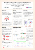 | Lonchay, M., Cornet, Y., Aquino, M., & Warnant, R. (23 April 2014). Spatio-Temporal Analysis of Equatorial Ionospheric Scintillations in the Frame of Absolute GNSS Positioning Algorithms [Poster presentation]. Workshop on Correlated Observation Errors, Reading, United Kingdom. |
 | Renson, P., Poncelet, N., Vandeloise, Y., Schmidt, R., & Cornet, Y. (2014). AUTOMATISATION DE LA DÉTECTION DES CRATÈRES LUNAIRES SUR DES IMAGES ET MNT PLANÉTAIRES. Bulletin de la Société Géographique de Liège, 61. Peer Reviewed verified by ORBi |
 | Canters, F., Cornet, Y., De Keersmaecker, M.-L., De Maeyer, P., Donnay, J.-P., Erpicum, M., Fettweis, X., Houbrechts, G., Marion, J.-M., Poty, E., & Thomas, I. (2013). Analyse du « Dossier méthodologique relatif à l'élaboration d'une carte positive de référence traduisant le cadre actualisé, associée à un productible minimal par lot permettant de développer le grand éolien à concurrence d'un objectif de 3.800 GWh à l'horizon 2020 ». https://orbi.uliege.be/handle/2268/157708 |
 | Estrada Orozco, N. K., Schmitz, S., Demoulin, A., Cornet, Y., & Dewitte, O. (26 September 2013). Susceptibilidad a deslizamiento una aproximación estadística en la parte alta de la cuenca del rio Naranjo [Paper presentation]. Seminario internacional: Organización comunitaria y ordenamiento territorial en la prevension de desastres, Quetzaltenango, GuatemalaCUNOC-PIC Guatemala, Quetzaltenango, Guatemala. |
 | Schockert, V., Lambinet, C., Cornet, Y., & Libois, R. (2013). Methodology used for the European badger (Meles meles) monitoring in Wallonie. In Y. Lecocq (Ed.), Abstracts of 31st IUGB congress (pp. 112). Bruxelles, Belgium: IUGB. Peer reviewed |
 | Denoël, M., Perez, A., Cornet, Y., & Ficetola, G. F. (May 2013). Similar local and landscape processes affect both a common and a rare newt species. PLoS ONE, 8 (5), 62727. doi:10.1371/journal.pone.0062727 Peer Reviewed verified by ORBi |
  | Traore, F., Cornet, Y., Denis, A., Wellens, J., & Tychon, B. (2013). Monitoring the evolution of irrigated areas with Landsat images using backward and forward change detection analysis in the Kou watershed. Geocarto International, 1-20. doi:10.1080/10106049.2012.744100 Peer Reviewed verified by ORBi |
 | Verbeiren, B., Van de Voorde, T., Canters, F., Binard, M., Cornet, Y., & Batelaan, O. (2013). Assessing urbanisation effects on rainfall-runoff using a remote sensing supported modelling strategy. International Journal of Applied Earth Observation and Geoinformation, 21, 92-102. doi:10.1016/j.jag.2012.08.011 Peer Reviewed verified by ORBi |
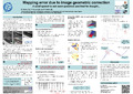 | Hallot, E., Cornet, Y., & Hallot, P. (April 2012). Mapping error due to image geometric correction [Poster presentation]. EGU General Assembly, Vienne, Autriche, avril 2012, Vienne, Austria. |
 | Cornet, Y., Binard, M., Ledant, M., Van der Kwast, H., Van de Voorde, T., & Canters, F. (2012). Predicting the spatial distribution of population based on impervious surface maps and modeled land use change. In K. G. Perakis & A. K. Moysiadis (Eds.), European Association of Remote Sensing Laboratories 32nd EARSeL Symposium Proceedings Advances in Geosciences Mykonos Island, Greece, 21 May - 24 May 2012. |
 | Schmidt, R., Bostelmann, J., Cornet, Y., Heipke, C., Philippe, C., Poncelet, N., de Rosa, D., & Vandeloise, Y. (2012). LANDSAFE: LANDING SITE RISK ANALYSIS SOFTWARE FRAMEWORK. International Archives of the Photogrammetry, Remote Sensing and Spatial Information Sciences, XXXIX (B4), 505-510. doi:10.5194/isprsarchives-XXXIX-B4-505-2012 |
 | Van de Voorde, T., van der Kwast, J., Canters, F., Engelen, G., Binard, M., Cornet, Y., & Uljee, I. (2012). A Remote Sensing Based Calibration Framework for the MOLAND Urban Growth Model of Dublin. International Journal of Agricultural and Environmental Information Systems, 3 (2), 1-21. doi:10.4018/jaeis.2012070101 Peer Reviewed verified by ORBi |
 | Hallot, E., Hallot, P., & Cornet, Y. (14 October 2011). Mapping the error due to image geometric correction ? [Paper presentation]. Mapping Day, Liège, Belgium. |
 | Thiry, V., Schockert, V., Libois, R., Cornet, Y., & Van der Linden, S. (2011). Analyse des potentialités d'accueil du lynx boréal (Lynx lynx) dans l'est de la province de Liège (Belgique). In R. Rosoux, M. D. N. de Bellefroid, J. Baillon, ... A. Moreau (Eds.), Lynx... le grand retour ? (pp. 65-69). Paris, France: Museum national d'histoire naturelle. Peer reviewed |
 | BOEMER, F., Cornet, Y., LIBIOULLE, C., SEGERS, K., Bours, V., & SCHOOS, R. (2011). 3-years experience review of neonatal screening for hemoglobin disorders using tandem mass spectrometry. Clinica Chimica Acta, 412 (15-16), 1476-9. doi:10.1016/j.cca.2011.04.031 Peer Reviewed verified by ORBi |
Pirson, S., Draily, C., Bovy, B., Cornet, Y., Court-Picon, M., Damblon, F., Debenham, N., Demoulin, A., De Wilde, B., Haesaerts, P., Juvigné, E., La Grappe, P., Parfitt, S., Pirouelle, F., Renson, V., Stewart, J., Udrescu, M., Van Neer, W., Wouters, W., & Toussaint, M. (2011). Contexte chronostratigraphique et paléoenvironnemental de la séquence de la grotte Walou : synthèse et perspectives. In S. Pirson, C. Draily, ... M. Toussaint, La grotte de Walou à Trooz (pp. 214-233). IPW/SPW. Peer reviewed |
Bovy, B., Cornet, Y., Juvigné, E., Renson, V., & Demoulin, A. (2011). La grotte Walou dans son cadre géomorphologique. In S. Pirson, C. Draily, ... M. Toussaint, La grotte de Walou à Trooz (pp. 60-69). IPW/SPW. Peer reviewed |
 | Plisnier, P.-D., Bompangue, D., Piarroux, R., Cocquyt, C., Jacobs, J., De Boeck, H., Giraudoux, P., Deleersnijder, E., Naithani, J., Hanert, E., Muyembe, J.-J., Miwanda, B., Nshombo, V., Poncelet, N., & Cornet, Y. (2011). CHOLTIC Epidémies de choléra au lac Tanganyika induites par les changements climatiques ? Science Connection, 35 (Juillet-Août), 38-42. |
 | Cornet, Y., Brogna, D., & Lejeune, P. (Other coll.). (20 October 2010). Utilisation conjointe d'ortho-images et d'images SPOT pour la cartographie de l'occupation du sol [Paper presentation]. Occupation du sol en Wallonie, Gembloux, Belgium. |
 | Bonnet, S., Brogna, D., Piron, J., Poncelet, N., Lejeune, P. (Ed.), & Cornet, Y. (Ed.). (2010). Télédétection spatiale de l'occupation du Sol en Wallonie. (Rapport final). Uliège-GRFMN/Géomatique. https://orbi.uliege.be/handle/2268/219974 |
 | Horion, S., Tychon, B., & Cornet, Y. (24 April 2010). Climatological characteristics of NDVI time series: challenges and constraints. Bulletin de la Société Géographique de Liège, 54, 137-144. Peer Reviewed verified by ORBi |
 | Poncelet, N., & Cornet, Y. (24 April 2010). Transformée de Hough et détection de linéaments sur images satellitaires et modèles numériques de terrain. Bulletin de la Société Géographique de Liège, 54, 145-156. Peer Reviewed verified by ORBi |
 | Cornet, Y., & Demoulin, A. (24 April 2010). De l'origine sismique de structures sédimentaires pléistocènes à Terreti, Calabre. Bulletin de la Société Géographique de Liège, 54, 49-62. Peer Reviewed verified by ORBi |
 | Bergamino, N., Horion, S., Stenuite, S., Cornet, Y., Loiselle, S., Plisnier, P.-D., & Descy, J.-P. (2010). Spatio-temporal dynamics of phytoplankton and primary production in Lake Tanganyika using a MODIS based bio-optical time series. Remote Sensing of Environment. doi:10.1016/j.rse.2009.11.013 Peer Reviewed verified by ORBi |
Van de Voorde, T., Binard, M., Cornet, Y., & Canters, F. (2010). Inferring urban morphology for the greater Dublin area from continuous sealed surface data: a metric based approach. In Joint SIG Workshop Urban - 3D - Radar - Thermal Remote Sensing and Developing Countries Ghent, 22-24 September 2010 Book of Proceedings EUROPEAN ASSOCIATION OF REMOTE SENSING LABORATORIES. |
van der Kwast, Van de Voorde, T., Binard, M., Engelen, G., Cornet, Y., & Canters, F. (2010). Using information on urban morphology derived from a time-series of medium resolution remote sensing data for the calibration of the moland urban growth model. In Joint SIG Workshop Urban - 3D - Radar - Thermal Remote Sensing and Developing Countries, Book of Proceedings EUROPEAN ASSOCIATION OF REMOTE SENSING LABORATORIES. |
 | Dewitte, O., Chung, C.-J., Cornet, Y., Daoudi, M., & Demoulin, A. (2010). Combining spatial data in landslide reactivation susceptibility mapping: A likelihood ratio-based approach in W Belgium. Geomorphology. doi:10.1016/j.geomorph.2010.06.010 Peer Reviewed verified by ORBi |
 | Horion, S., Tychon, B., & Cornet, Y. (2010). Modelling climate control on cropland and grassland development using phenologically tuned variables. Geophysical Research Abstracts, 12. Peer reviewed |
 | Sorjamaa, A., Lendasse, A., Cornet, Y., & Deleersnijder, E. (January 2010). An Improved Methodology for Filling Missing Values in Spatiotemporal Climate Dataset: Application to Tanganyika Lake Dataset. Computational Geosciences, 14 (1), 55-64. doi:10.1007/s10596-009-9132-3 Peer Reviewed verified by ORBi |
 | Horion, S., Bergamino, N., Stenuite, S., Descy, J.-P., Plisnier, P.-D., Loiselle, S., & Cornet, Y. (2010). Optimized extraction of daily bio-optical time series derived from MODIS/Aqua imagery for Lake Tanganyika, Africa. Remote Sensing of Environment. doi:10.1016/j.rse.2009.11.012 Peer Reviewed verified by ORBi |
 | Binard, M., Tack, F., Van de Voorde, T., Cornet, Y., & Canters, F. (2010). Use of multi-angle high-resolution imagery and 3D information for urban land-cover classification: a case study on Istanbul. In Joint SIG Workshop Urban - 3D - Radar - Thermal Remote Sensing and Developing Countries - Ghent, 22-24 September 2010 Book of Proceedings EUROPEAN ASSOCIATION OF REMOTE SENSING LABORATORIES. |
 | Plisnier, P.-D., Mgana, H., Kimirei, I., Chande, A., Makasa, L., Chimanga, J., Zulu, F., Cocquyt, C., Horion, S., Bergamino, N., Naithani, J., Deleersnijder, E., André, L., Descy, J.-P., & Cornet, Y. (02 January 2009). Limnological variability and pelagic fish abundance (Stolothrissa tanganicae and Lates stappersii) in Lake Tanganyika. Hydrobiologia, 625 (1), 117-134. doi:10.1007/s10750-009-9701-4 Peer Reviewed verified by ORBi |
 | Pissart, A., & Cornet, Y. (2009). Les lithalses allongées des Hautes Fagnes et du Pays de Galles. Environnements périglaciaires, 16, 53-54. Peer reviewed |
 | Canters, F., Van de Voorde, T., Binard, M., & Cornet, Y. (2009). Characterising urban morphology with spectral unmixing and spatial metrics: a case study on Dublin. In Proceedings of the 24th International Cartographic Conference (ICC 2009). |
 | Van de Voorde, T., van der Kwast, J., Engelen, G., Binard, M., Cornet, Y., & Canters, F. (2009). Quantifying intra-urban morphology of the Greater Dublin area with spatial metrics derived from medium resolution remote sensing data. In IEEE Proceedings of the 7th International Urban Remote Sensing Conference : Shanghai, May 20-22, 2009. IEEE. doi:10.1109/URS.2009.5137595 |
 | Houbrechts, G., Van Campenhout, J., Hallot, E., Cornet, Y., & Petit, F. (2009). Analysis of lateral mobility of channels at different spatial and time scales (Ardenne massif, Belgium) [Poster presentation]. 7th International conference on Geomorphology, Melbourne, Australia. |
 | Daoudi, M., Ozer, A., Gérard, P., Dewitte, O., Abdellaoui, A., Salmon, M., & Cornet, Y. (2008). Prédiction des zones propices au ravinement par un modèle de régression logistique intégrant des données de télédétection. Cas du sous-bassin versant de l’oued Alayem - Beni Slimane, Algérie. In S. Randriamanga, S. Rakotoniaina, Y. Auda, S. Rakotondraompiana, ... J.-P. Gastellu-Etchegorry (Eds.), Les XIèmes Journées Scientifiques du Réseau Télédétection de l'AUF (pp. 73). Peer reviewed |
 | Perez, A., Ficetola, G. F., Cornet, Y., & Denoël, M. (October 2008). Distribution and decline of an endangered amphibian species (Triturus cristatus): Effect of pond characteristics and landscape matrix [Poster presentation]. 15th Benelux Congress of Zoology, Liège, Belgium. |
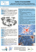 | Lambotte, J.-M., Daxhelet, D., Halleux, J.-M., & Cornet, Y. (18 September 2008). Cartes d’accessibilité. Outil d’aide à la décision en matière d’aménagement du territoire en vue de lutter contre la dépendance automobile [Poster presentation]. Exposition Planet’ULg, Liège, Belgium. |
 | Dewitte, O., Jasselette, J. C., Cornet, Y., Van den Eeckhaut, M., Collignon, A., Poesen, J., & Demoulin, A. (09 June 2008). Tracking landslide displacements by multi-temporal DTMs: A combined aerial stereophotogrammetric and LIDAR approach in western Belgium. Engineering Geology, 99 (1-2), 11-22. doi:10.1016/j.enggeo.2008.02.006 Peer Reviewed verified by ORBi |
 | Cornet, Y. (2008). Etude du contrôle de la qualité de l’orthoimage et du Modèle Numérique de Surface. Vols 2006-2007. https://orbi.uliege.be/handle/2268/79046 |
 | Demoulin, A., Bovy, B., Rixhon, G., & Cornet, Y. (30 October 2007). An automated method to extract fluvial terraces from digital elevation models: The Vesdre valley, a case study in eastern Belgium. Geomorphology, 91 (1-2), 51-64. doi:10.1016/j.geomorph.2007.01.020 Peer Reviewed verified by ORBi |
 | Horion, S., Eerens, H., Tychon, B., & Cornet, Y. (2007). Spatial aggregation of low resolution satellite data for the monitoring of vegetation response to climatic stresses : analysis of the spatial heterogeneity of aggregated entities. In Proceedings Envisat Symposium. ESA. Peer reviewed |
 | Dewitte, O., Jasselette, J.-C., Cornet, Y., Collignon, A., & Demoulin, A. (2007). Tracking landslide evolution over decades: application of aerial digital photogrammetry to the Oudenaarde area (W Belgium) [Paper presentation]. Society for Mathematical Geology XIth International Congress, Liège, Belgium. Peer reviewed |
 | Canters, F., Van de Voorde, T., Goossens, R., Devriendt, D., Tack, F., Batelaan, O., Dams, J., Engelen, G., Cornet, Y., Binard, M., Lavalle, C., & Barredo, J. (2007). Measuring and Modeling Urban Dynamics: Impact on Quality of Life and Hydrology. Objectives and methodology [Paper presentation]. IGAARS 2007. doi:10.1109/IGARSS.2007.4423220 |
 | Cornet, Y. (2007). Chapitre 7. Approche du contexte géomorphologique de Chagar Bazar et restitution de la paléosurface ''naturelle'' sous le Tell. In Ö. Tunca, A. McMahon, ... Baghdo (Eds.), Chagar Bazar (Syrie) II. Les vestiges post-akkadiens du chantier D et études diverses (pp. 285-310). Leuven, Belgium: Peeters. |
 | Daoudi, M., Dewitte, O., Gérard, P., Cornet, Y., Nicolas, J., Abdellaoui, A., & Ozer, A. (2007). Controlling factors of gully erosion in the upper part of the Isser river watershed (Algiers, N. Algeria). Geophysical Research Abstracts, 9. Peer reviewed |
 | Dewitte, O., Chung, C.-J., Cornet, Y., & Demoulin, A. (2007). Strategies to estimate ground susceptibility to landslide reactivation. A probabilistic application in W Belgium (Oudenaarde) [Paper presentation]. Society for Mathematical Geology XIth International Congress, Liège, Belgium. Peer reviewed |
 | Binard, M., Cornet, Y., & Donnay, J.-P. (2006). The usefulness of VHR images for public administrations in an urban hilly region. In A. Marçal (Ed.), "Global Developments in Environmental Earth Observation from Space" (pp. 567-574). Rotterdam, Netherlands: Millpress. Peer reviewed |
 | Jadot, C., Donnay, A., Acolas, M.-L., Cornet, Y., & Bégout-Anras, M.-L. (January 2006). Activity patterns, home-range size, and habitat utilization of Sarpa salpa (Teleostei : Sparidae) in the Mediterranean Sea. ICES Journal of Marine Science, 63 (1), 128-139. doi:10.1016/j.icesjms.2005.06.010 Peer Reviewed verified by ORBi |
 | Binard, M., Devriendt, D., Cornet, Y., & Donnay, J.-P. (2006). Analysis of buildings height computed on a DSM generated from a VHR satellite stereopair. In P. Hostert, A. Damm, ... S. Schiefer (Eds.), Proceedings of the First Workshop of the EARSeL Special Interest Group on Urban Remote Sensing "Challenges and Solutions". Berlin, Germany: EARSeL. Peer reviewed |
 | Cornet, Y., Daxhelet, D., Halleux, J.-M., Klinkenberg, A.-C., & Lambotte, J.-M. (09 November 2005). Cartographie de l’accessibilité par les alternatives à la voiture [Paper presentation]. Journée des Géographes Belges - Colloque « Mobilité, Société en Environnement en Cartes », Gand, Belgium. |
 | Cornet, Y., Grevesse, J., Binard, M., Peeters, C., Tihon, G., Bastin, T., & Donnay, J.-P. (2005). DSM from SPOT5-HRS images: extraction and validation. In K. Jacobsen, R. Goossens, ... P. Winkler (Eds.), Proceding of the EARSeL Workshop 3D-Remote Sensing: Porto, June 10 - 11, 2005. Peer reviewed |
 | Cornet, Y., Daxhelet, D., Halleux, J.-M., Klinkenberg, A.-C., & Lambotte, J.-M. (2005). Cartographie de l’accessibilité par les alternatives à la voiture. In F. Witlox & V. Van Acker (Eds.), Les Journées Géographiques Belges. Mobilité, Société et Environnement en Cartes (pp. 355-364). Zelzate, Belgium: DCL Print & Sign. |
 | Devriendt, D., Goossens, R., Binard, M., & Cornet, Y. (2005). Accuracy assessment of an IKONOS derived DSM over urban and suburban area. In K. Jacobsen, R. Goossens, ... P. Winkler (Eds.), Proceding of the EARSeL Workshop 3D-Remote Sensing: Porto, June 10 - 11, 2005. Porto, Portugal: EARSeL. Peer reviewed |
 | Cornet, Y., Fitschy, C., Gobbato, O., & Erpicum, M. (2005). Modélisation de la distribution spatiale des précipitations en Sicile. Bulletin de la Société Géographique de Liège, 46, 11-26. Peer Reviewed verified by ORBi |
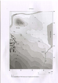 | Cornet, Y., & Alvarez Perez, A. (2004). Chapitre 2: Contexte géologique et géomorphologique du chantier L (Tell Amarna, Syrie). In M. Molist & Ö. Tunca (Eds.), Tell Amarna (Syrie) I, la période de Halaf (pp. 7-13). Leuven, Belgium: Peeters. |
 | Cornet, Y., & Binard, M. (2004). Which metrics to assess and compare the quality of image fusion products ? In New Strategies for European Remote Sensing. Rotterdam, Netherlands: Millpress. Peer reviewed |
 | Cornet, Y., Binard, M., & Donnay, J.-P. (2004). Intérêt de la fusion d’images à haute résolution spatiale pour la classification de l’occupation du sol en milieu urbain. Revue Internationale de Géomatique, 14 (3-4), 417-439. Peer Reviewed verified by ORBi |
 | Cornet, Y., Schenke, C., De Bethune, S., Binard, M., & Muller, F. (2003). Stratégies de fusion d’images P/XS basées sur les principes colorimétriques et l’Egalisation de Statistiques Locales. Bulletin - Société Française de Photogrammétrie et de Télédétection, 169, 35-45. Peer reviewed |
 | Binard, M., De Man, J., Séba, G., Vansteenvoort, M., Gamanya, R., Cornet, Y., Goossens, R., Donnay, J.-P., & De Maeyer, P. (2003). Urban use of VHR images on Bukavu (Democratic Republic of Congo). In Proceedings of the Second Workshop of the EARSeL Special Interest Group on Remote Sensing for Developing Countries, Bonn, Germany September 18-20, 2002. EARSeL: Paris, France (pp. 34-41). Paris, France: EARSeL. Peer reviewed |
 | Laboury, D., Renotte, Y., Tilkens, B., Dominique, M., Da Col, A., Schumacker, B., Billen, R., Cornet, Y., & Cornélis, B. (2002). The OSIRIS Project (Optical Systems for Interferometric-Photogrammetric Relief Investigation and Scanning). Development of a device for 3D numerical recording of archaeological and epigraphic documents by optoelectronic processes. In W. Boehler (Ed.), PROCEEDINGS OF THE CIPA WG 6 INTERNATIONAL WORKSHOP ON SCANNING FOR CULTURAL HERITAGE RECORDING. Peer reviewed |
 | Daxhelet, D., Kessler, L., Lambotte, J.-M., Merenne-Schoumaker, B. (Ed.), Halleux, J.-M. (Ed.), & Cornet, Y. (Other coll.). (2002). Etude complémentaire relative aux profils d'accessibilité - profils de mobilité. Namur, Belgium: Conférence Permanente du Développement Territorial. https://orbi.uliege.be/handle/2268/3513 |
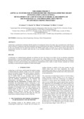 | Laboury, D., Renotte, Y., Tilkens, B., Dominique, M., Billen, R., & Cornet, Y. (2002). The OSIRIS Project (Optical Systems for Interferometric-Photogrammetric Relief Investigation and scanning), Development of a device for 3D numerical recording of archaeological and epigraphic documents by optoelectronic processes. In Proceedings of the CIPA WG6 international workshop on Scanning for Cultural Heritage Recording (pp. 139-142). Peer reviewed |
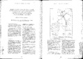 | Gobert, O., Ozer, A., & Cornet, Y. (2002). Etude diachronique de 1948 à 1990 de l’évolution du littoral des plages de Nonza et d’Albo (Cap Corse) par traitement analigique de photographies aériennes. In G. Fierro (Ed.), MED PICTURE, Mediterranean Project for the Improvement of Cooperation in Training between Universities, Regions and Enterprises. Programma Leonardo da Vinci (pp. 282-290). Gênes, Italy: Omicron Editrice. |
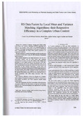 | Cornet, Y., de Béthune, S., Binard, M., Muller, F., Legros, G., & Nadasdi, I. (2001). RS Data Fusion by Local Mean and Variance Matching Algorithms: their Respective Efficiency in a Complex Urban Context [Paper presentation]. IEEE/ISPRS Joint Workshop on Remote Sensing and Data Fusion over Urban Areas, Rome, Italy. Peer reviewed |
 | Quoilin, H., Ozer, A., Cornet, Y., & Pissart, A. (2001). La photographie aérienne en période de sècheresse comme source de renseignements géologiques en Wallonie. Bulletin de la Société Géographique de Liège, 40 (2001-1), 33-40. Peer Reviewed verified by ORBi |
Closson, D., Cornet, Y., Ozer, A., Hansen, H., De Rauw, D., & Barbier, C. (1999). Cartography of Microclimatic Zones Using InSAR DTM. In ESA (Ed.), Proc. FRINGE'99 Symposium. Peer reviewed |
Cornet, Y., De Rauw, D., Ozer, A., Moxhet, J., Closson, D., Doulliez, J.-Y., Ozer, P., & Kourgli, A. (1998). Interférométrie RSO et analyses géomorphométriques à caractère tectonique en Jordanie. In J. M. Dubois, M. Bernier, J. P. Fortin, ... F. Boivin (Eds.), Série Actualité scientifique - La réalité de terrain en télédétection: pratiques et méthodes. Canada: Presses de l'Université du Québec. Peer reviewed |
 | Cornet, Y., & Demoulin, A. (1998). Neotectonic implications of a lineament-coplanarity analysis in Southern Calabria, Italy. Geological Society Special Publication, 146, 111-127. doi:10.1144/GSL.SP.1999.146.01.06 Peer reviewed |
 | Alexandre, J., Erpicum, M., Mabille, G., & Cornet, Y. (1998). Précipitations atmosphériques et altitude. Prélude à une cartographie des montants annuel et mensuels en Belgique. Publications de l'Association Internationale de Climatologie, 11, 219-226. Peer reviewed |
Cornet, Y., Doulliez, J.-Y., Moxhet, J., Closson, D., Kourgli, A., Ozer, A., Ozer, P., & De Rauw, D. (1997). Use of ERS tandem data to produce digital elevation models by interferometry and study land movements by differential interferometry in Calabria and Jordan [Paper presentation]. Third ERS Symposium "Space at the service of our environment", Florence, Italy. Peer reviewed |
 | Closson, D., Ozer, A., Tunca, Ö., Kourgli, A., & Cornet, Y. (March 1997). Etude de faisabilité : détection de sites archéologiques et cartographie géomorphologique en Syrie par l'exploitation d'images des satellites ERS et SPOT2 intégrées dans un système d'information géographique. ESA Bulletin, SP-414 (1), 449-452. Peer Reviewed verified by ORBi |
Gobert, D., Ozer, A., & Cornet, Y. (September 1996). Etude diachronique de 1948 à 1990 de l’évolution du littoral des plages de Nonza et d’Albo (Cap Corse) par traitement analogique de photographies aériennes. Photo-interprétation, 34 (1996/1), 47-61. Peer reviewed |
Cornet, Y. (1996). The interests and limits of ERS1 SAR data for the bathymetric and topographic cartography of shallow waters sea bottom and tidal flats [Paper presentation]. Second ERS Application Workshop, Londres, United Kingdom. Peer reviewed |
Cornet, Y., & Ozer, P. (1996). The contribution of ERS1 SAR data in neotectonics. In T. D. Guyenne (Ed.), Proceedings of the Second ERS Applications Workshop, London, UK, 6-8 December 1995 (pp. 265-272). Noordwijk, Netherlands: ESA Publications Division, ESTEC. Peer reviewed |
 | Cornet, Y. (1996). Evolution géomorphologique de la région d'Amarna (Syrie) et ses relations avec les traces d'occupation humaine. Geo-Eco-Trop: Revue Internationale de Géologie, de Géographie et d'Écologie Tropicales, 20 (1-4), 109-138. |
Cornet, Y., & Ozer, P. (1996). Contribution des données RSO de ERS1 à l’étude de la néotectonique [Paper presentation]. Symposium international "Extraction de paramètres bio-géophysiques à partir des données RSO pour les applications terrestres, Toulouse, France. Peer reviewed |
Cornet, Y., & Ozer, A. (1996). Apport des données RSO de ERS1 dans l’étude bathymétrique et pour la cartographie des zones intertidales. In Extraction de paramètres bio-géophysiques à partir des données RSO pour les applications terrestres (pp. 27-38). Toulouse, France: CNES. Peer reviewed |
Ozer, A., Cornet, Y., & Comhaire, A. L. (1995). Apport des images RAS de ERS1 dans l’étude de la houle et de son influence sur le transit sédimentaire littoral. In F. Boivin, M.-R. Boussema, P. Lafrance, ... J.-M. Dubois (Eds.), Télédétection des ressourcces en eau (pp. 237-250). Sainte-Foy, Canada: Presses de l'Université du Québec. Peer reviewed |
Cornet, Y., Ozer, A., & Ferrari, M. (1995). Apport des données RSO de ERS1 dans l’étude bathymétrique et pour la cartographie des zones intertidales. Documents de travail du Centre National de Recherches Géomorphologiques, 30, 1-12. |
Cornet, Y., & Ozer, P. (1995). Apport de la télédétection (RSO de ERS1, SPOT et photographies aériennes) associée à la cartographie pour l’étude de la néotectonique en Equateur: interprétation 3D des linéaments. Documents de travail du Centre National de Recherches Géomorphologiques, 30, 13-30. |
Cornet, Y. (1995). L’encaissement des rivières ardennaises au cours du Quaternaire. In A. Demoulin (Ed.), L'Ardenne. Essai de géographie physique. Hommage au Professeur A. Pissart (pp. 155-177). |
 | Ozer, A., Ozer, P., & Cornet, Y. (1994). Natural hazards evaluation by remote sensing in Equator. In Space Scientific Research in Belgium /Volume 3 Earth Observation: Part 2 / Chapter 4: Earth and Sea application (pp. 93-95). Brussels, Belgium: SSTC. |
Ozer, P., Cornet, Y., Moreno, A., & Ozer, A. (1994). Using SAR of ERS1 for evaluation of natural risks in the Andes (Ecuador) [Poster presentation]. Scientific and Technical Poster Session, World Conference on Natural Disaster Reduction, Yokohama, Japan. |
Ozer, P., Cornet, Y., Moreno, A., & Ozer, A. (1994). Natural risks evaluation by remote sensing: lineaments research in the Pastaza basin (Ecuador). In Proceedings of the First ERS-1 Pilot Project Workshop, Toledo, Spain, 22-24 June 1994 (pp. 205-209). Noordwijk, Netherlands: ESA Publications Division, ESTEC. Peer reviewed |
Ozer, P., Cornet, Y., & Ozer, A. (1994). Evaluation, par télédétection, des risques naturels: signification des linéaments dans le bassin du Pastaza (Equateur). Projet Pilote ESA PP2-B7 - Programme TELSAT III Projet T3/12/019 - Rapport final. Liège, Belgium: Laboratoire de Géomorphologie et de Géologie du Quaternaire, Université de Liège. https://orbi.uliege.be/handle/2268/17334 |
Cornet, Y., Comhaire, A. L., & Ozer, A. (1993). Significativity of wave length computation using spatial autocorrelation theory on SAR image of ERS1. In B. Kaldeich (Ed.), Proceedings of the Second ERS1 Symposium "Space at the service of our environment" (pp. 941-944). Noordwijk, Netherlands: ESA Publications Division, ESTEC. Peer reviewed |
Ozer, A., Cornet, Y., & Comhaire, A. L. (1993). Morphodynamique des côtes et caractéristiques énergétiques de la houle étudiée grâce au SAR de ERS-1. In B. Kaldeich (Ed.), Proceedings of the First ERS1 Symposium "Space at the service of our environment" (pp. 851-856). Noordwijk, Netherlands: ESA Publications Division, ESTEC. Peer reviewed |
Cornet, Y. (1993). Les dépôts holocènes de la région d'Amarna (Syrie) et leurs raccords avec les traces d'occupations humaines. Akkadica : Périodique Bimestriel de la Fondation Assyriologique Georges Dossin, 83 (mai-juin). |
Ozer, A., Cornet, Y., & Comhaire, A. L. (1992). Sedimentology and morphology of some western mediterranean beaches (Finale Ligure in Western Liguria, Calvi in Corsica and Sorso in Sardinia). Bollettino di Oceanologia Teorica ed Applicata, 10 (2-3-4), 93-108. Peer reviewed |
 | Ozer, A., Fierro, G., Ramella, A., Cornet, Y., & Cremer, J.-F. (1991). Correlation between meteo-marine conditions and sedimentary balance of the beaches: aims of the study and methodological approaches [Paper presentation]. Med-ERS Workshop, Frascati, Italy. |
Picazzo, M., Cornet, Y., Corradi, N., Casale, R., & Pedemonte, S. (1989). Quelques exemples d'utilisation des géotextiles dans le domaine de la géomorphologie appliquée. Documents de travail du Centre National de Recherches Géomorphologiques, 28. |