[en] Remote sensing has long been used as a powerful tool for the observation in cryospheric sciences. With the advances brought by the ESA Copernicus program, Earth observation goes a step further in its ability to get acquisitions at very high temporal rate. This is even amplified in polar regions due to heliosynchronism of satellites’ orbits. Earth observation shifts from sporadic observations to Earth monitoring.
Observations are a critical aspect for the assessment of geophysical models. The ability of a model to replicate observations is crucial as a benchmark. It also allows to refine our comprehension of Earth systems, such as in cryospheric sciences.
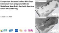
In this work, we are using the regional climate model MAR to compute the surface melt on a domain focusing on the Roi Baudouin Ice Shelf, Queen Maud Land, East Antarctica. From the results, we extract the number of days with surface melt in a region. In parallel, we employ remote sensing to obtain comparison data. Synthetic aperture radar appears as a solution of choice thanks to its day-and-night (critical in polar regions) and atmospheric-free capabilities. Radar backscattering anomalies between different dates are witnesses of substantial increase of soil moisture. Using Sentinel-1 in its wide-swath modes (namely Interferometric Wide Swath and Extra Wide Swath modes) and multiple satellite paths, near-daily acquisitions can be obtained. By comparing the two independent results, we better constraint model’s outputs while also better interpret SAR acquisitions.
F.R.S.-FNRS - Fonds de la Recherche Scientifique ; BELSPO - SPP Politique scientifique - Service Public Fédéral de Programmation Politique scientifique